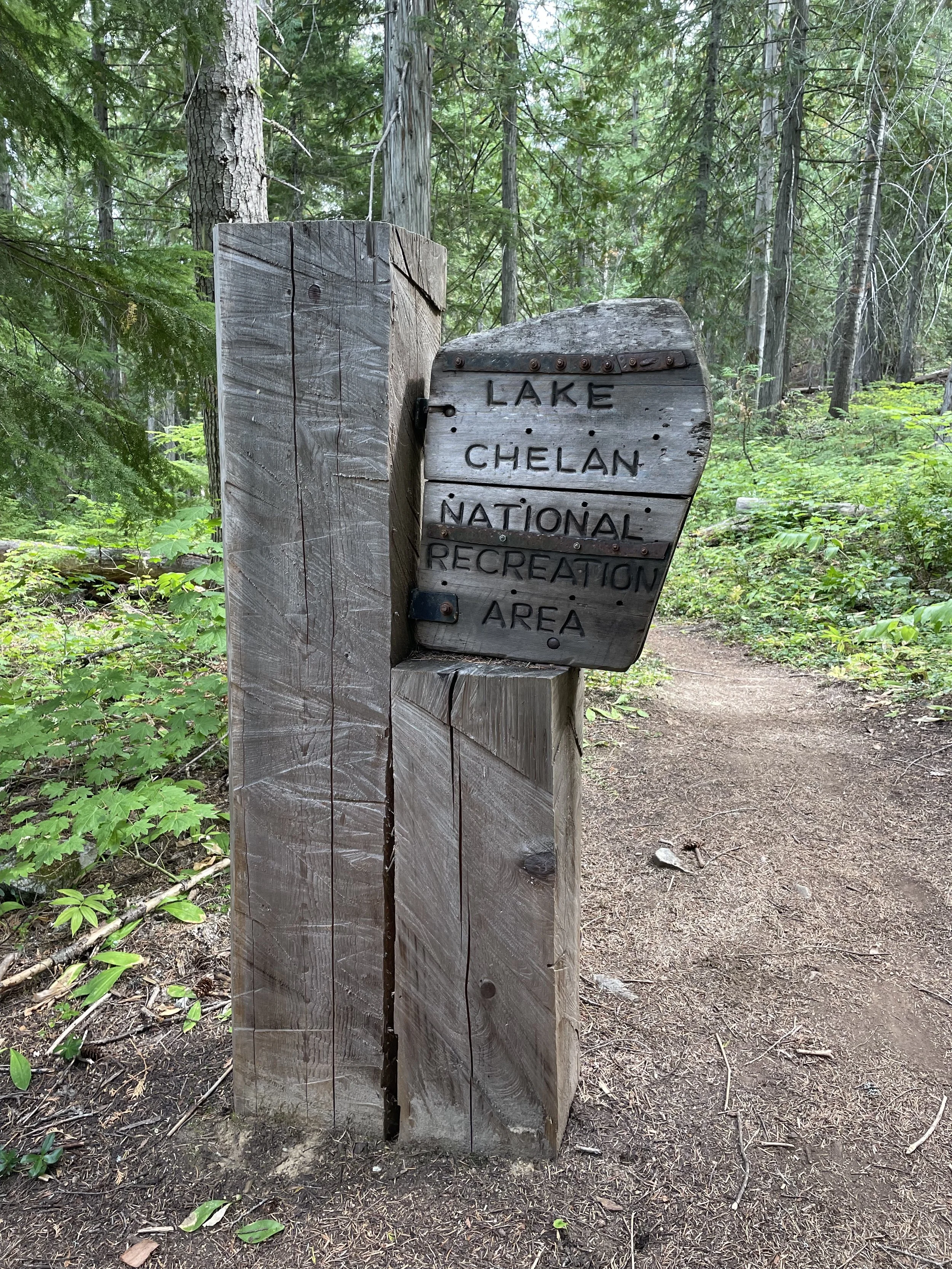
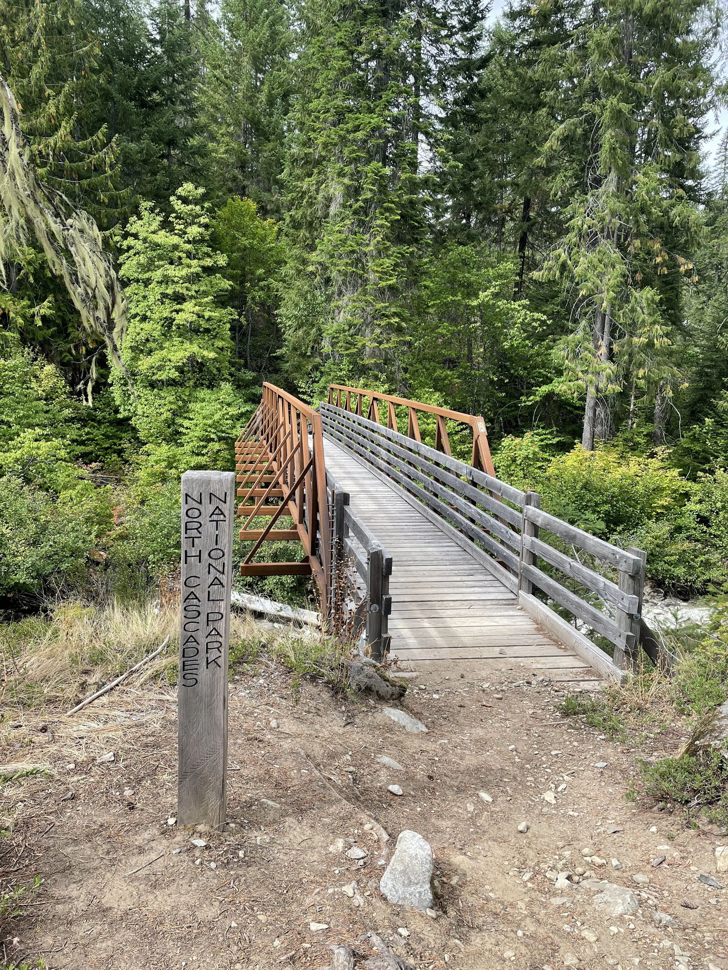
The Hellish and Heavenly Glacier Peak Wilderness
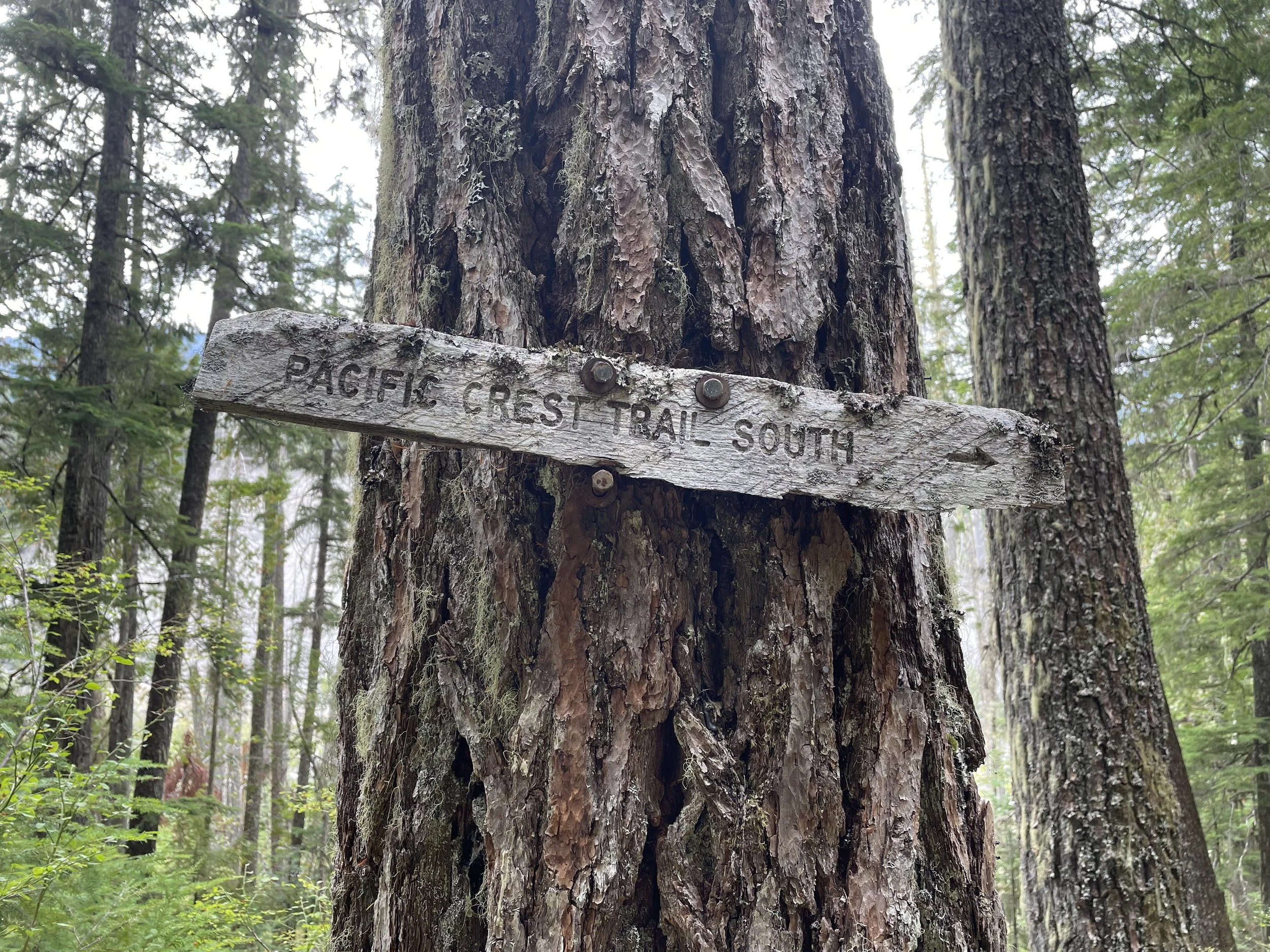
Mile 2479.3
We left Steven’s Pass today after a wonderful and unexpected zero. We stayed at the Mountaineers hostel for an extra day and it was so incredibly peaceful and cozy. There were shared meals, everyone was kind and respectful, and the volunteer hosts, Jula and Bryce, were so welcoming. There was a hot drink station and snacks throughout the day, with breakfast and dinner cooked for everyone. It ended up being one of my favorite town stops of the whole trail.
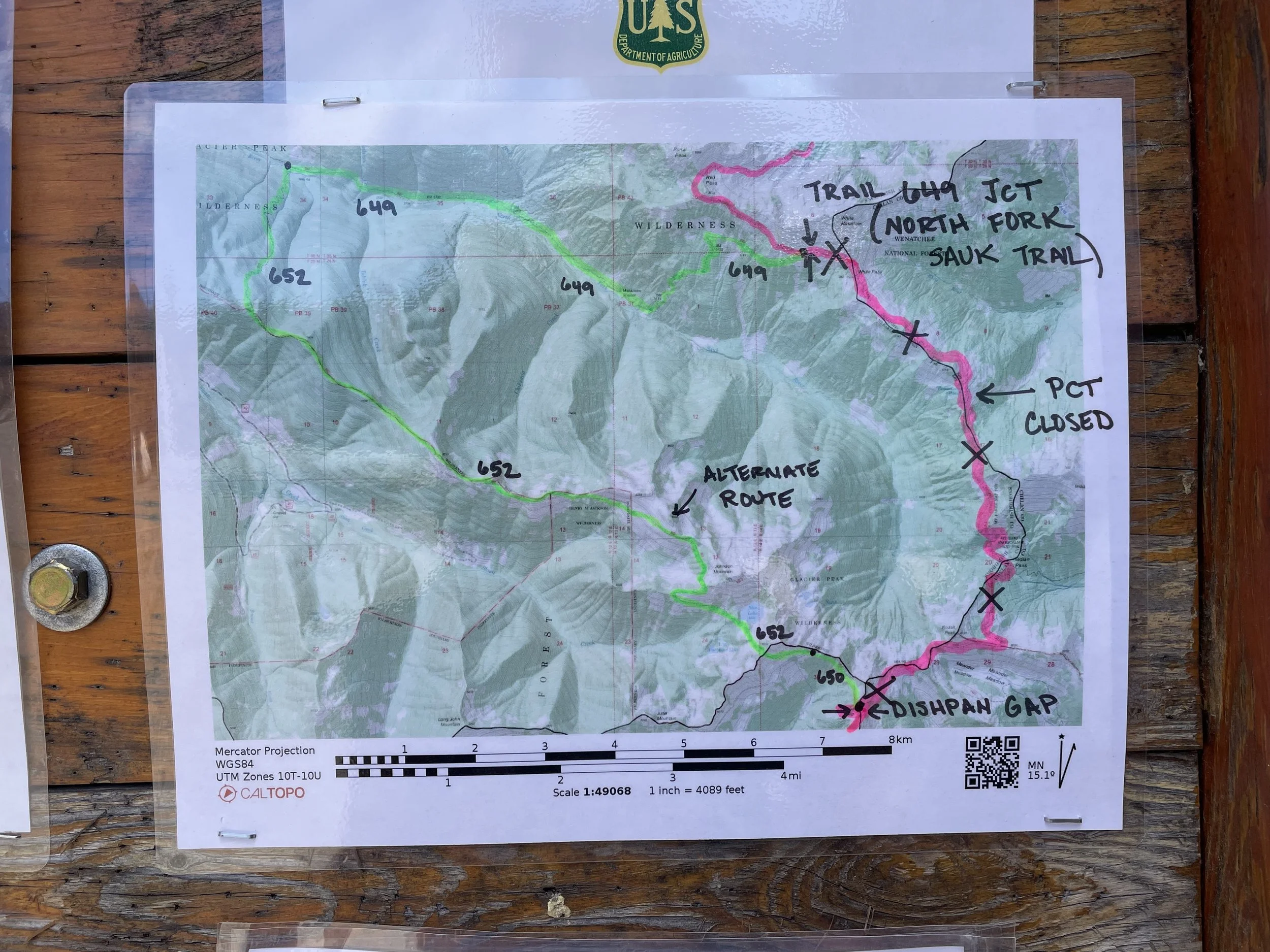
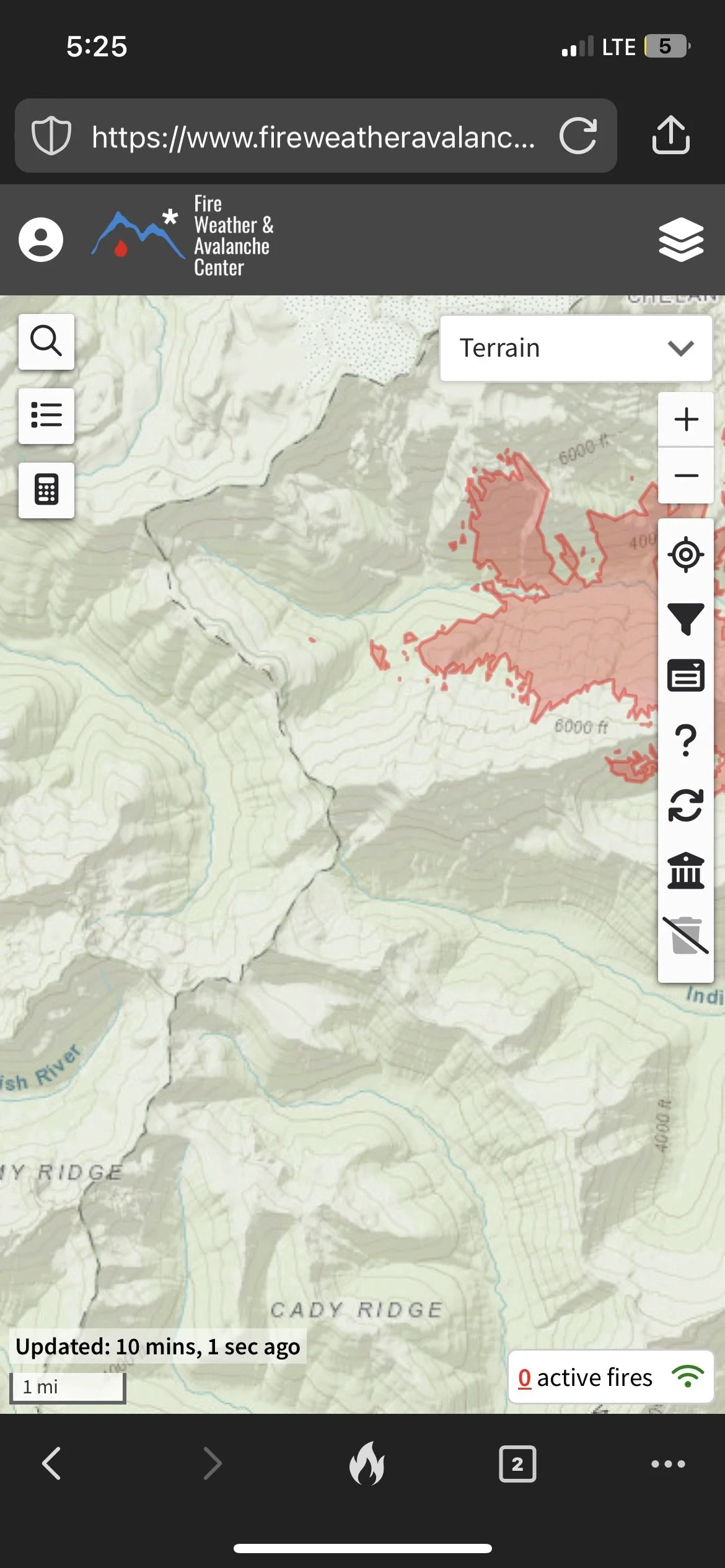
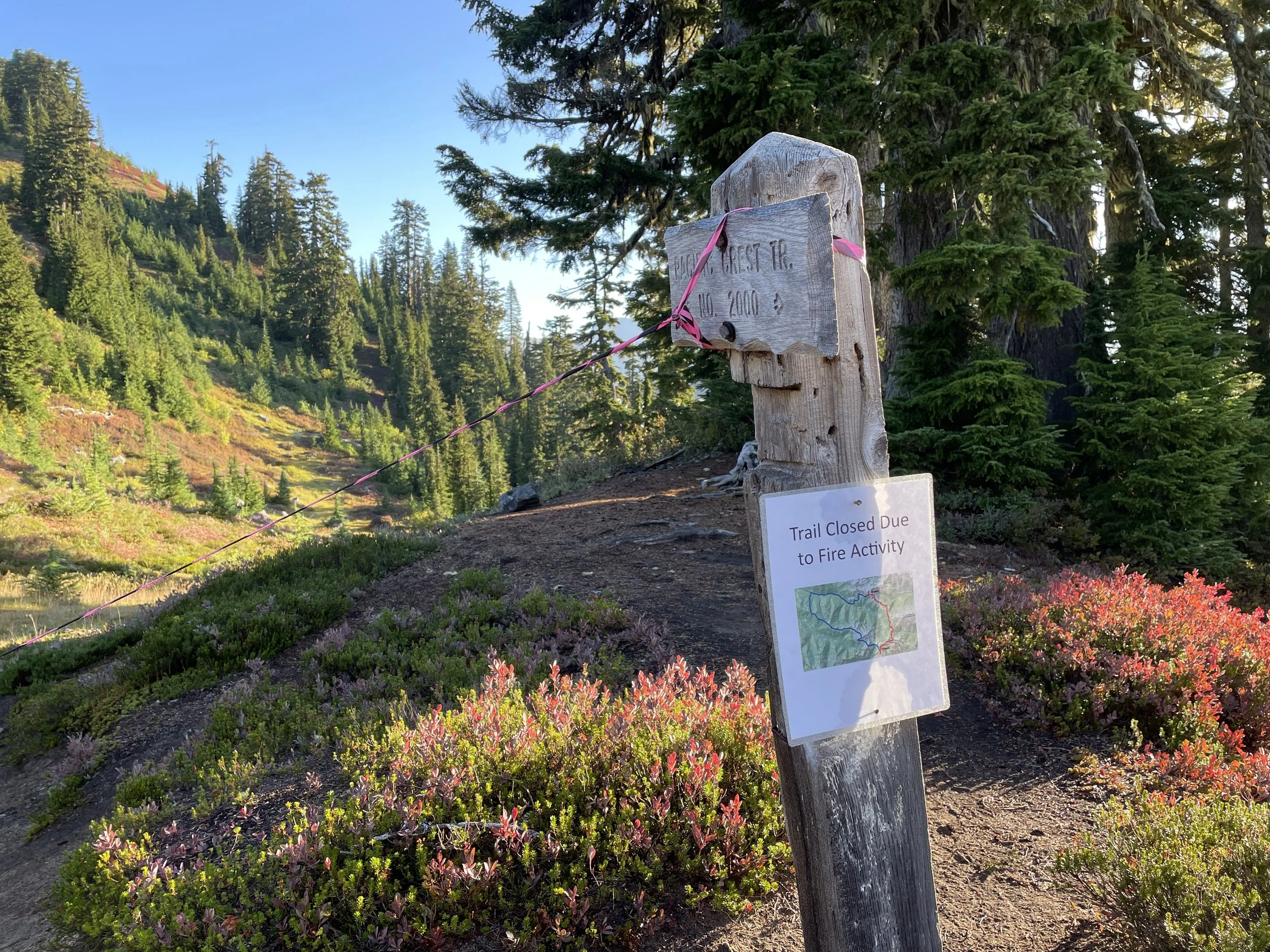
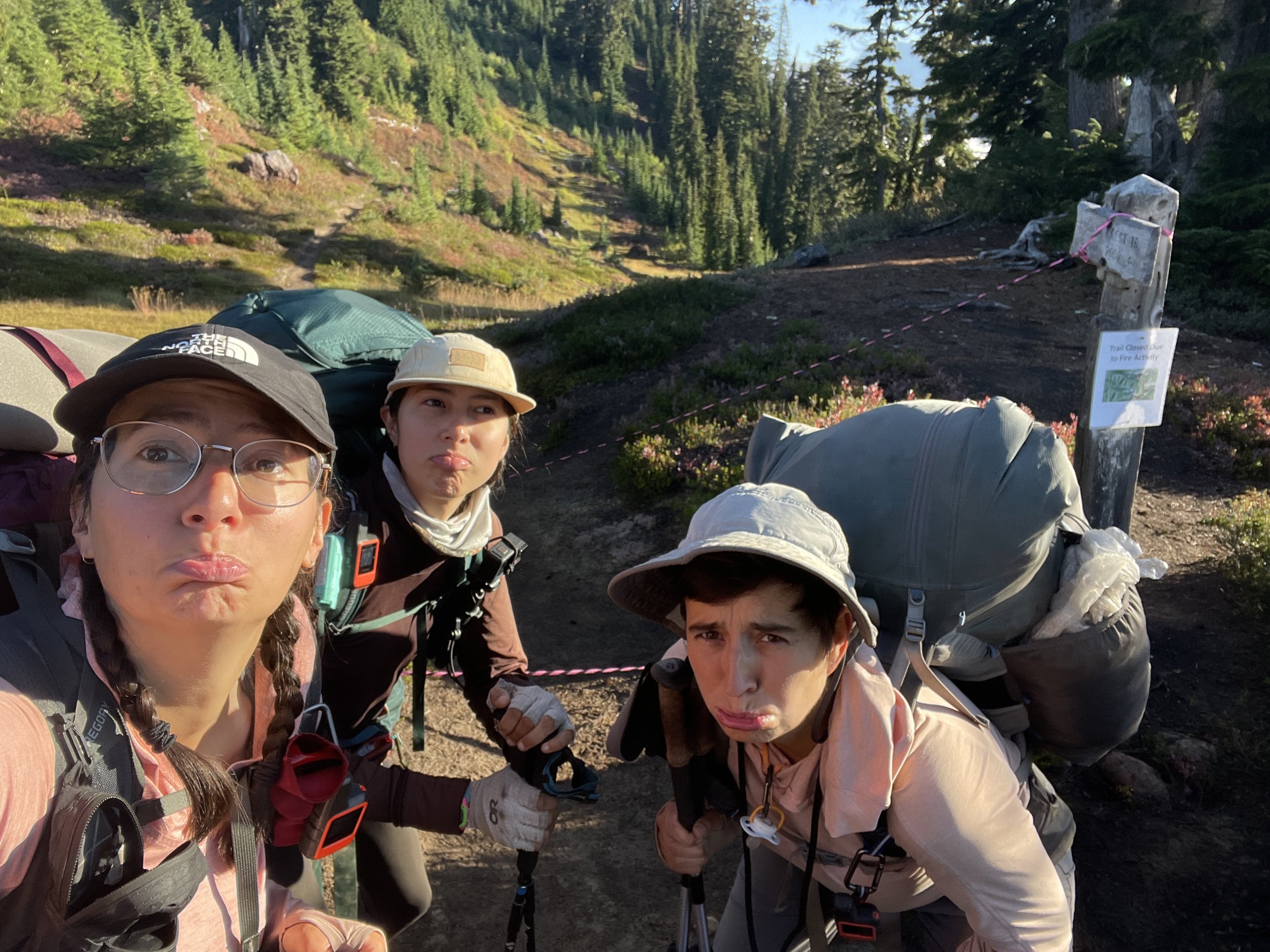
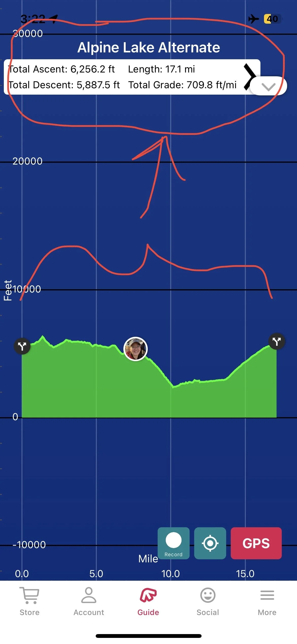
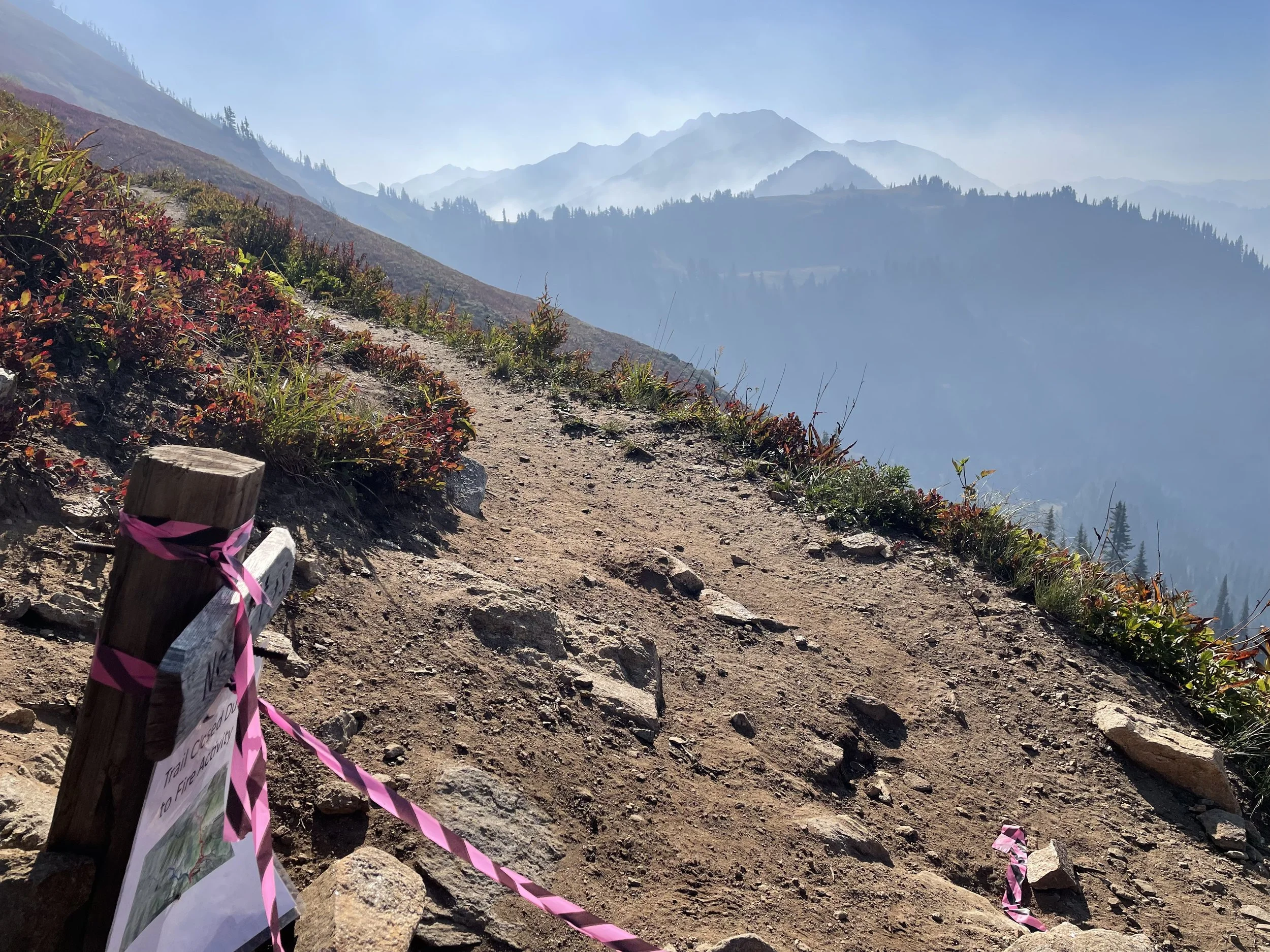
While in Stevens Pass, we looked at the upcoming fires and closures, and decided we would hike the roughly 100 miles from here to Stehekin. Once we get to Stehekin we’ll bypass the Blue Lake fire just north of there by getting shuttled up to Harts Pass. It skips about 50 miles of the trail (including the fire), and positions us about 30 miles south of the Canadian border. Because of the bypass and what will be only like 2.5 days of hiking after Harts Pass, right now feels like our last full stretch of trail. It’s pretty surreal.
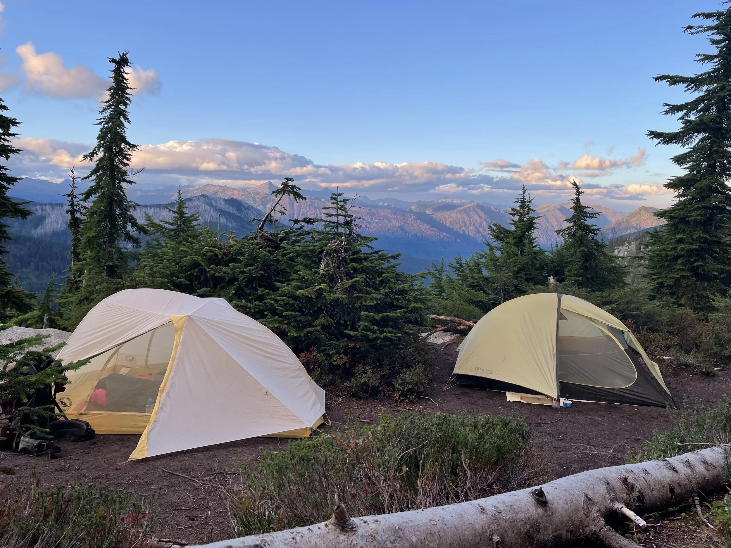
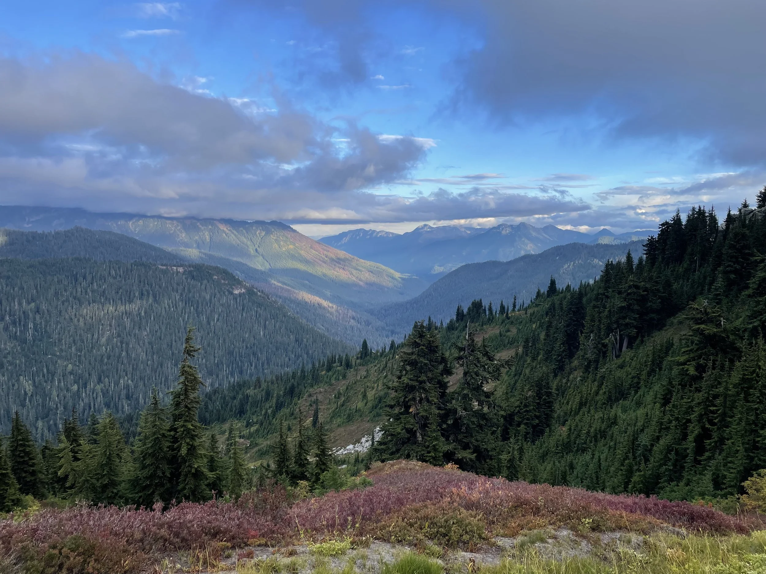
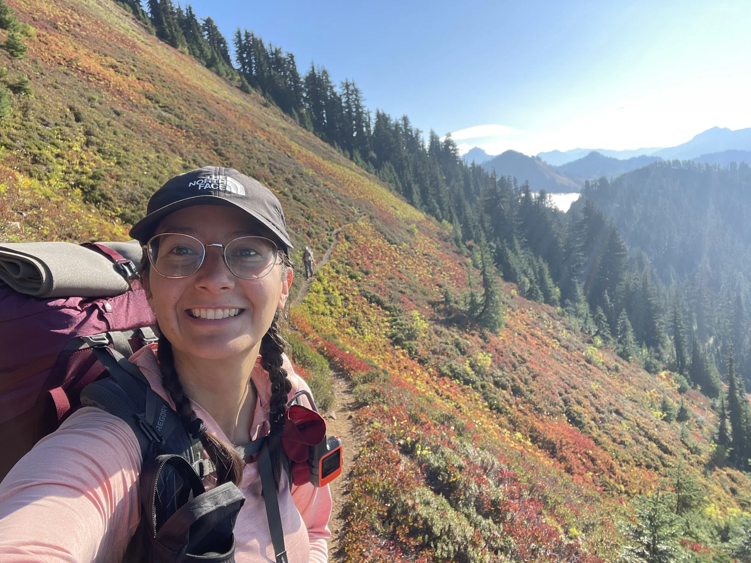
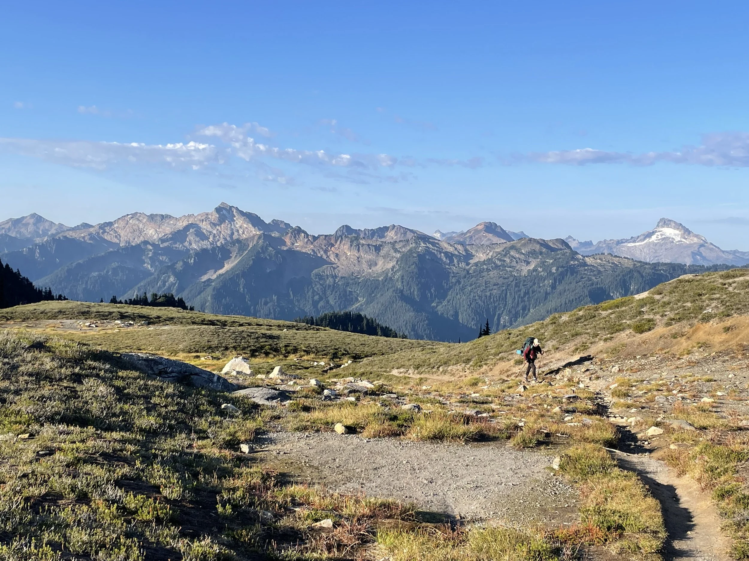
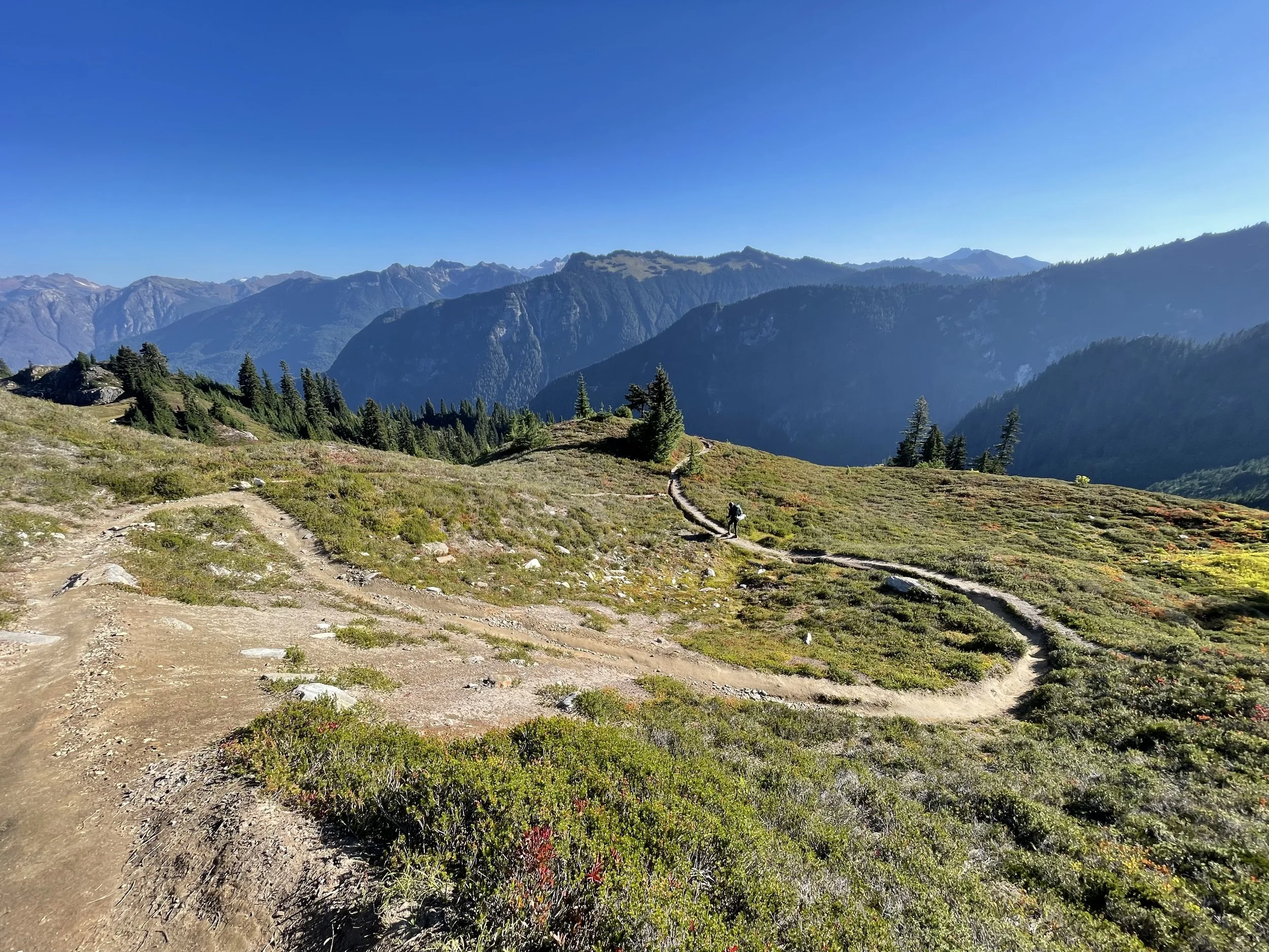
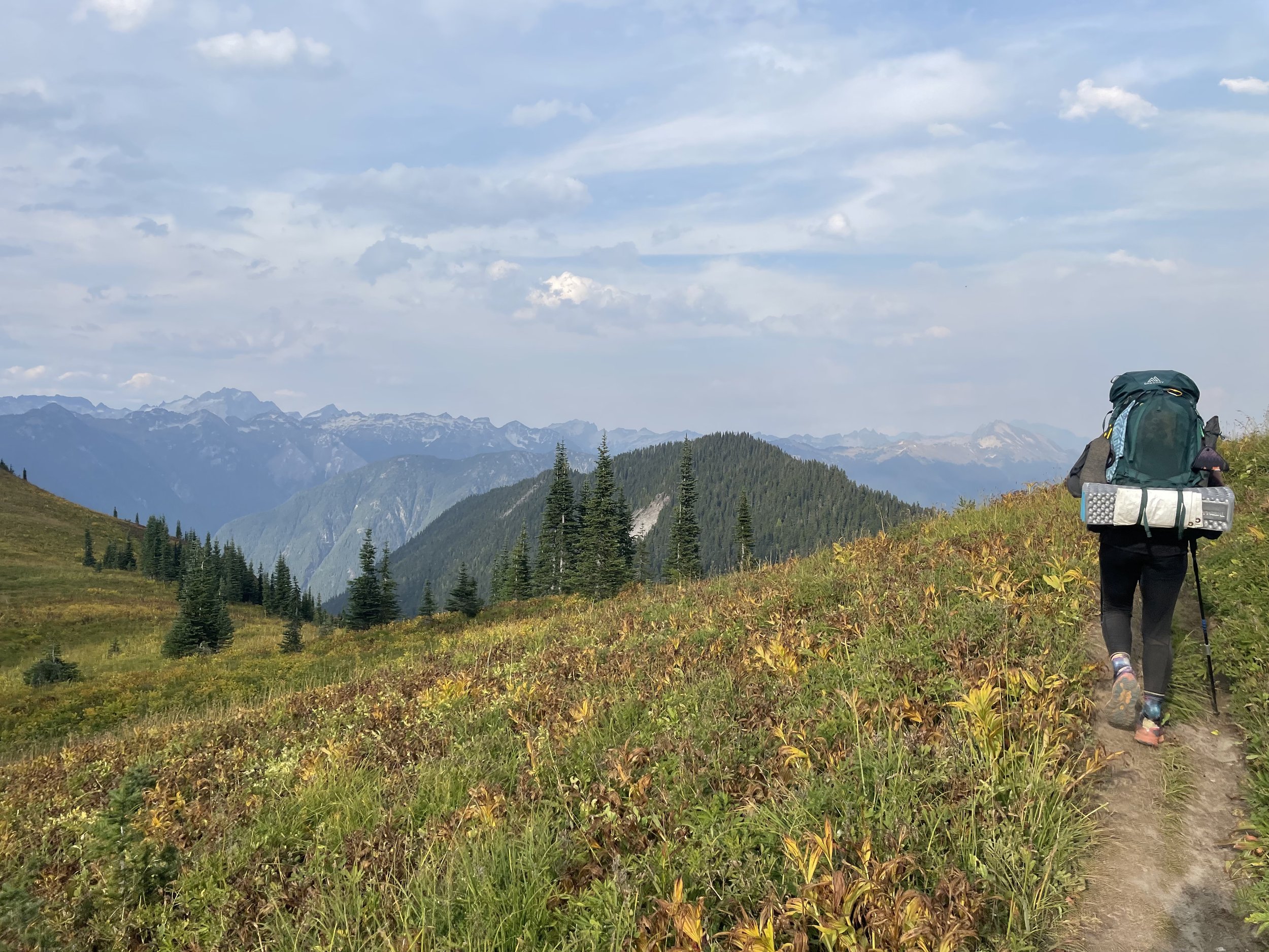
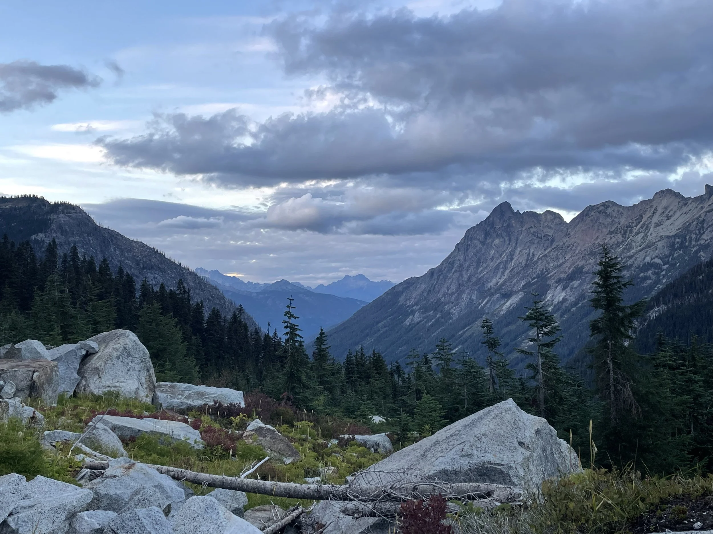
Back on trail with Ziploc now and we did about 12.5 miles after leaving the hostel around 11:00am. Got to camp at 6pm, and our tentsite is so stunning. It’s likely one of the best views from a tentsite that I’ve ever had. You can see for miles with the entire mountain range ahead of us. We have a view of Grizzly Peak which we’ll summit first thing tomorrow morning, and we are also able to see the smoke from the Airplane Lake wildfire that’s about 15-20 miles ahead, burning east of the PCT.
Should be a good stretch ahead of us, lots of ups and downs, but we’ve been told the views are unmatched. We packed 6-7 days of food, and I’m hoping I did a good job of making sure I have enough. Time will tell. Stehekin is 95.3 miles away.

Mile 2496.2
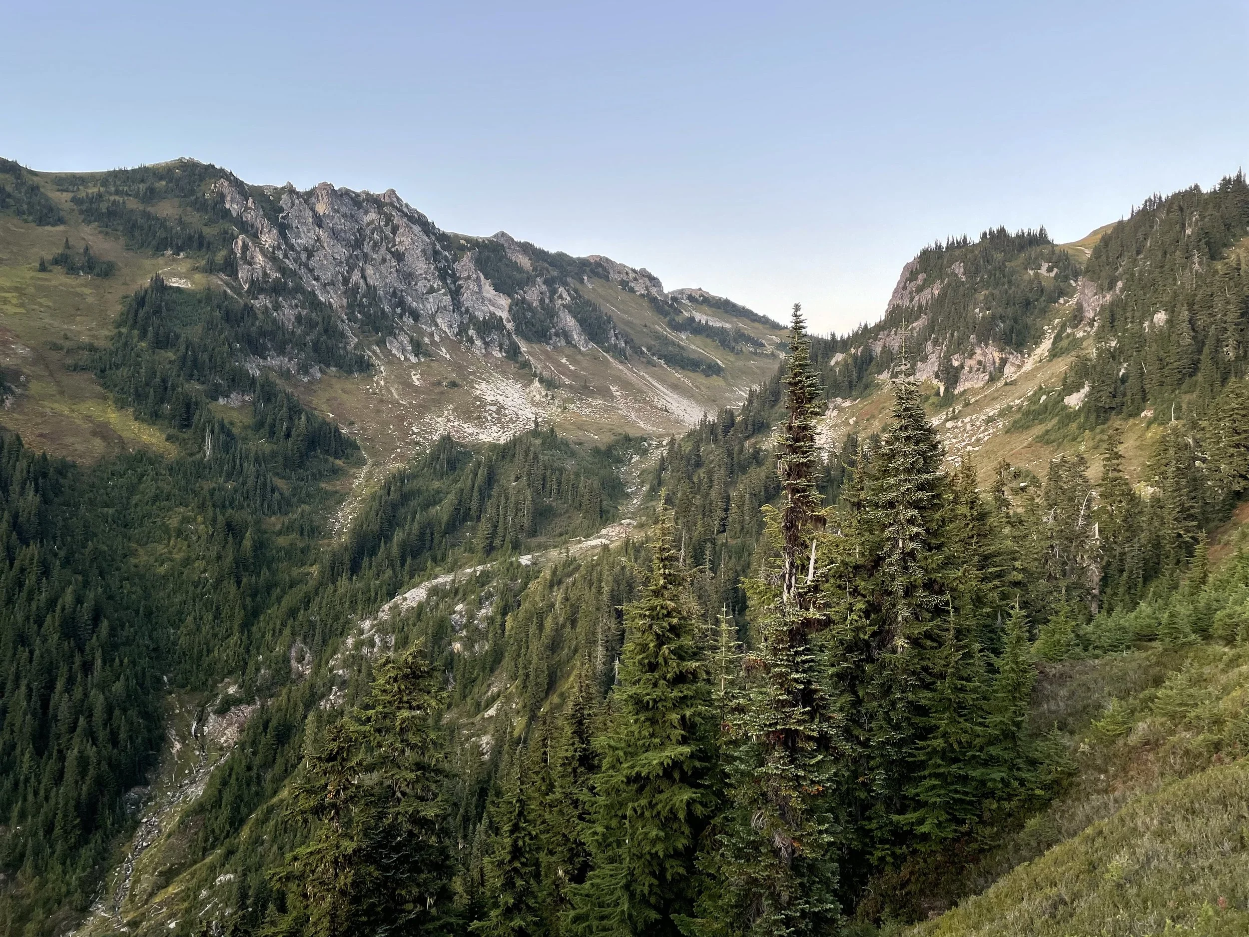
Lovely day today. We started out the day summiting Grizzly Peak, potentially one of the only named peaks that the PCT actually goes up and over. All of the other peaks we’ve had the chance to summit have been alternates or spur trails (Mt. San Jacinto, Mt. Baden Powell, Mt. Thielsen, etc).
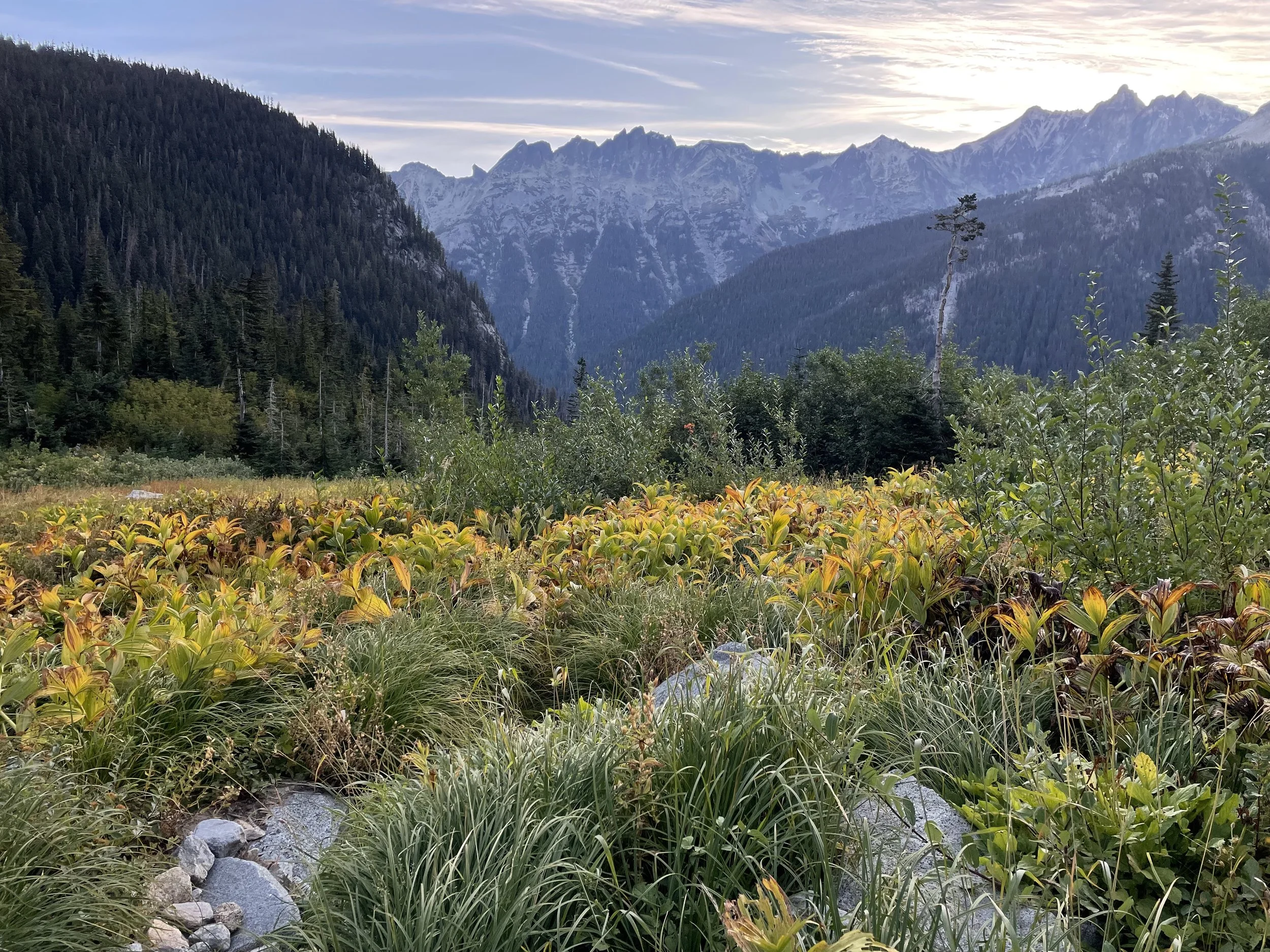
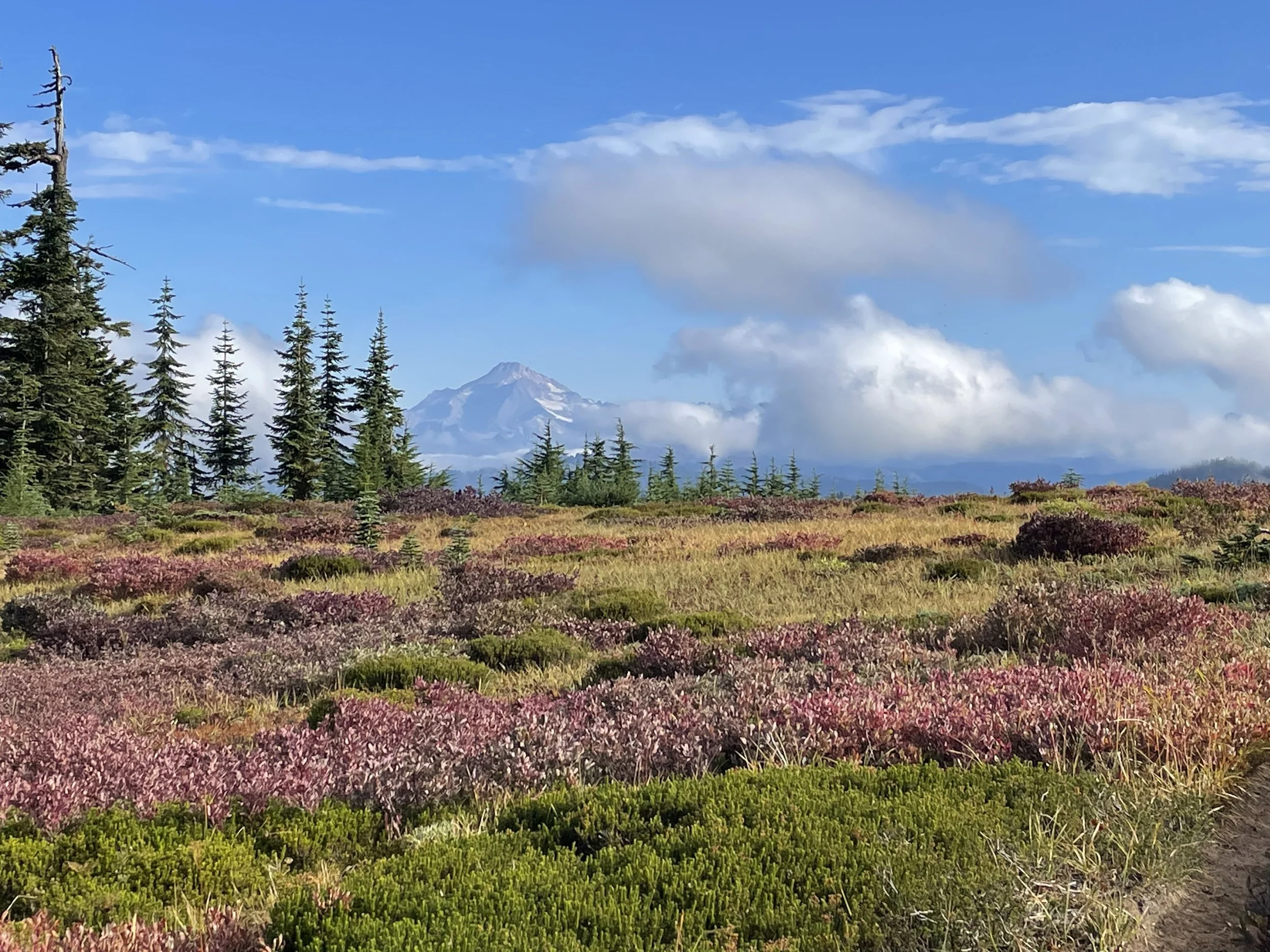
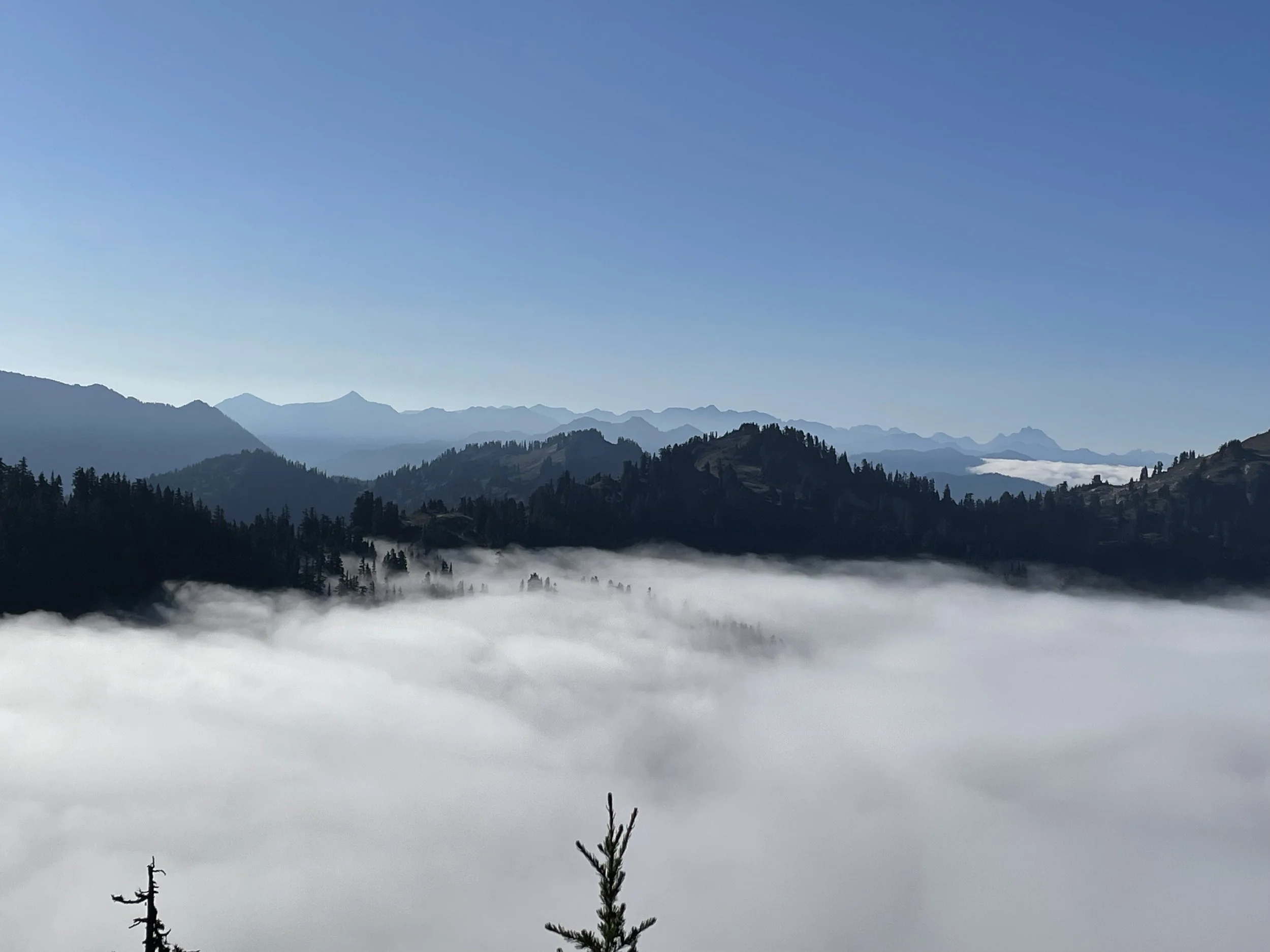
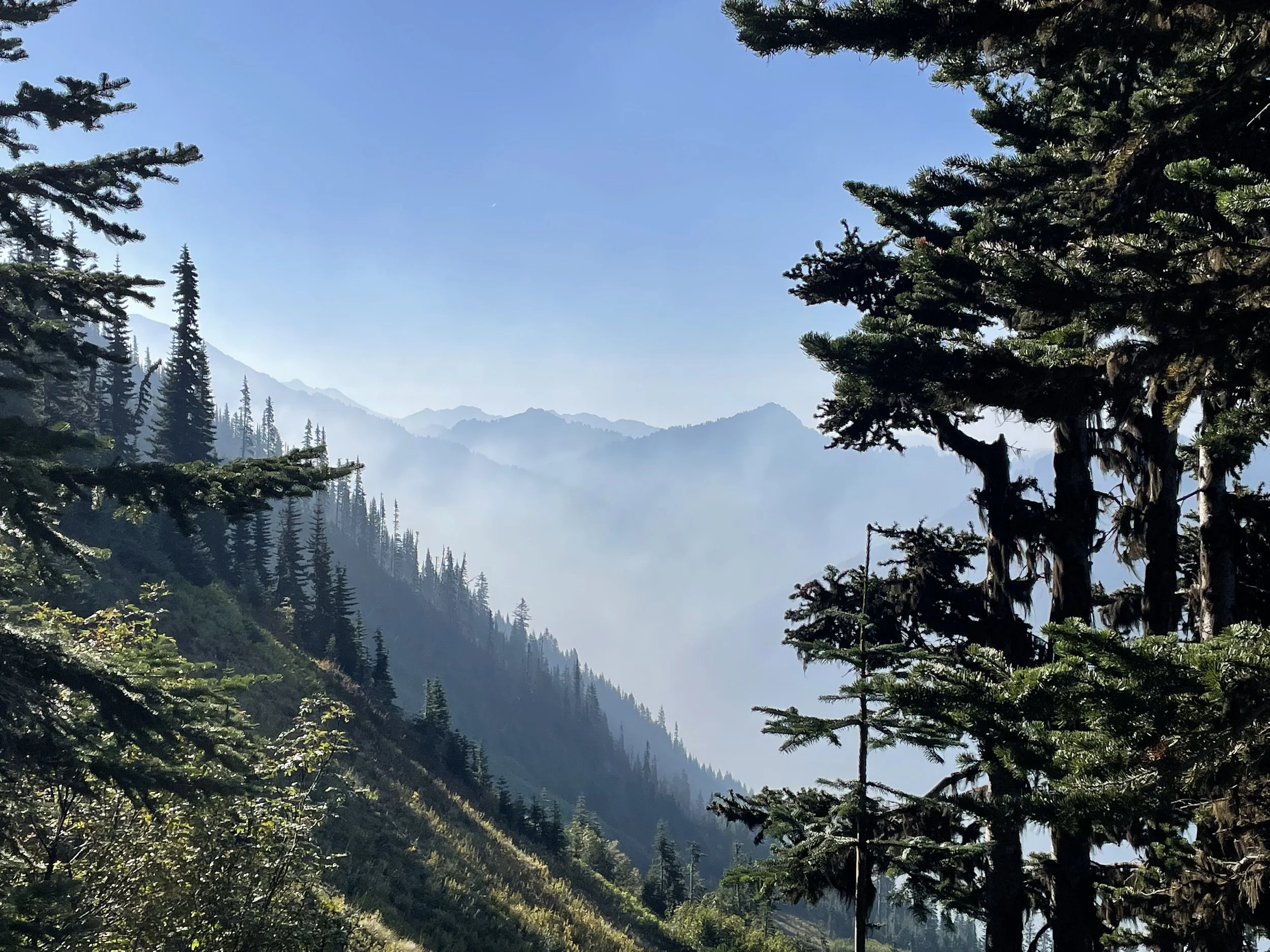
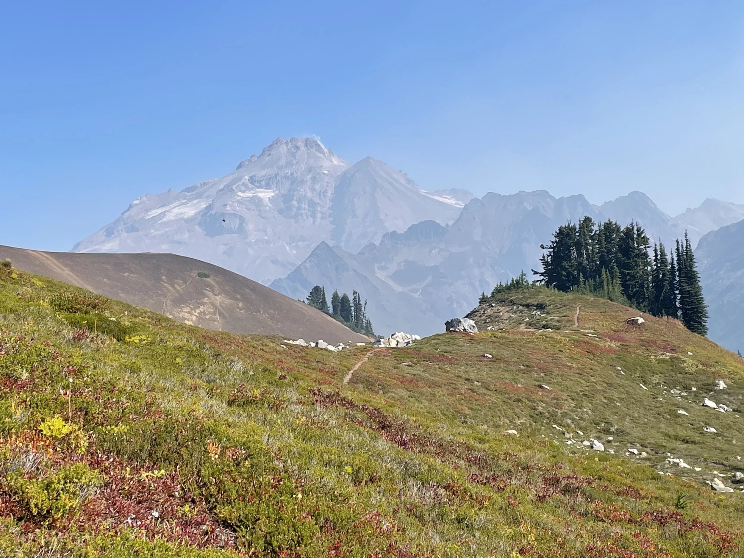
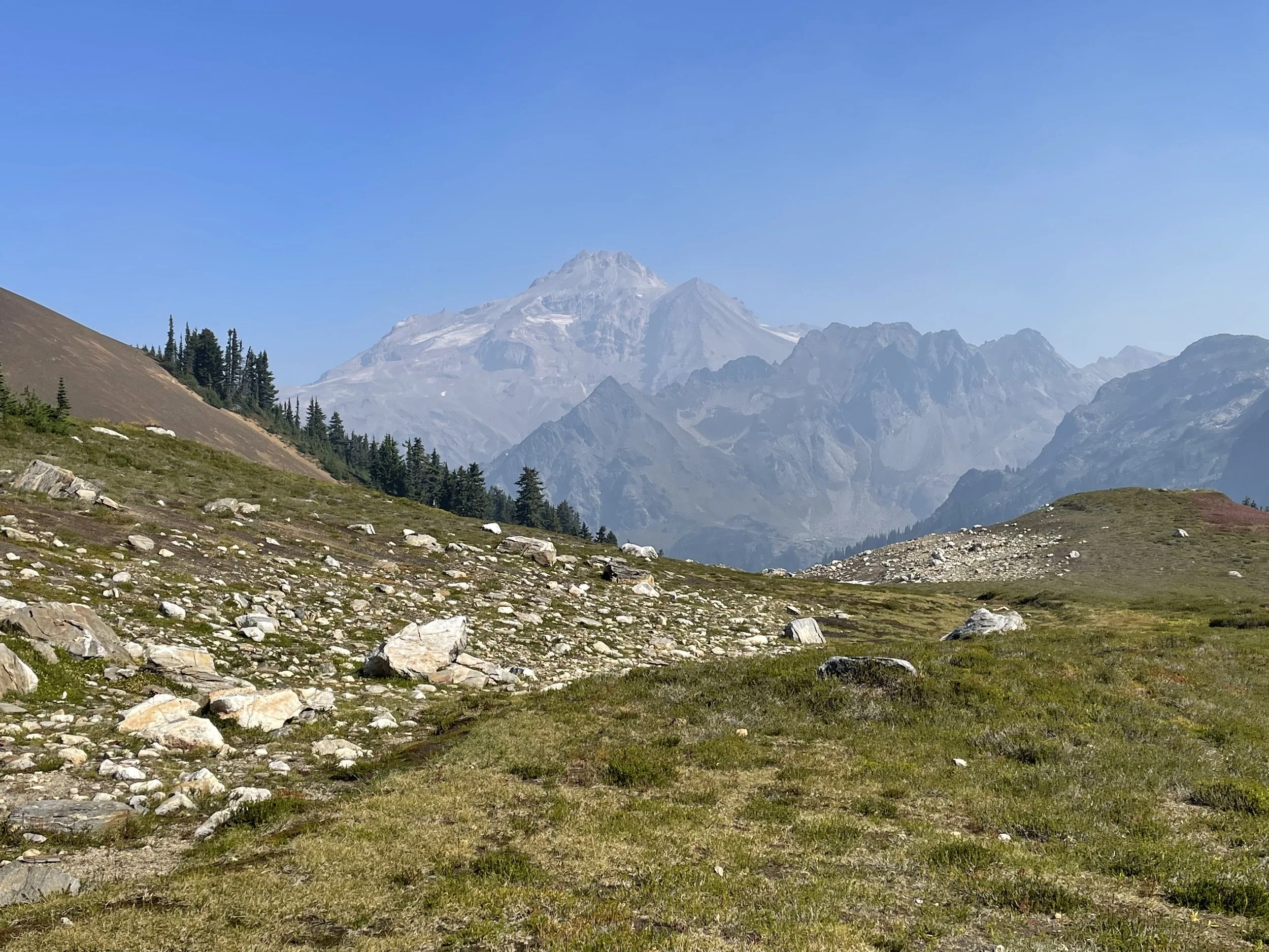
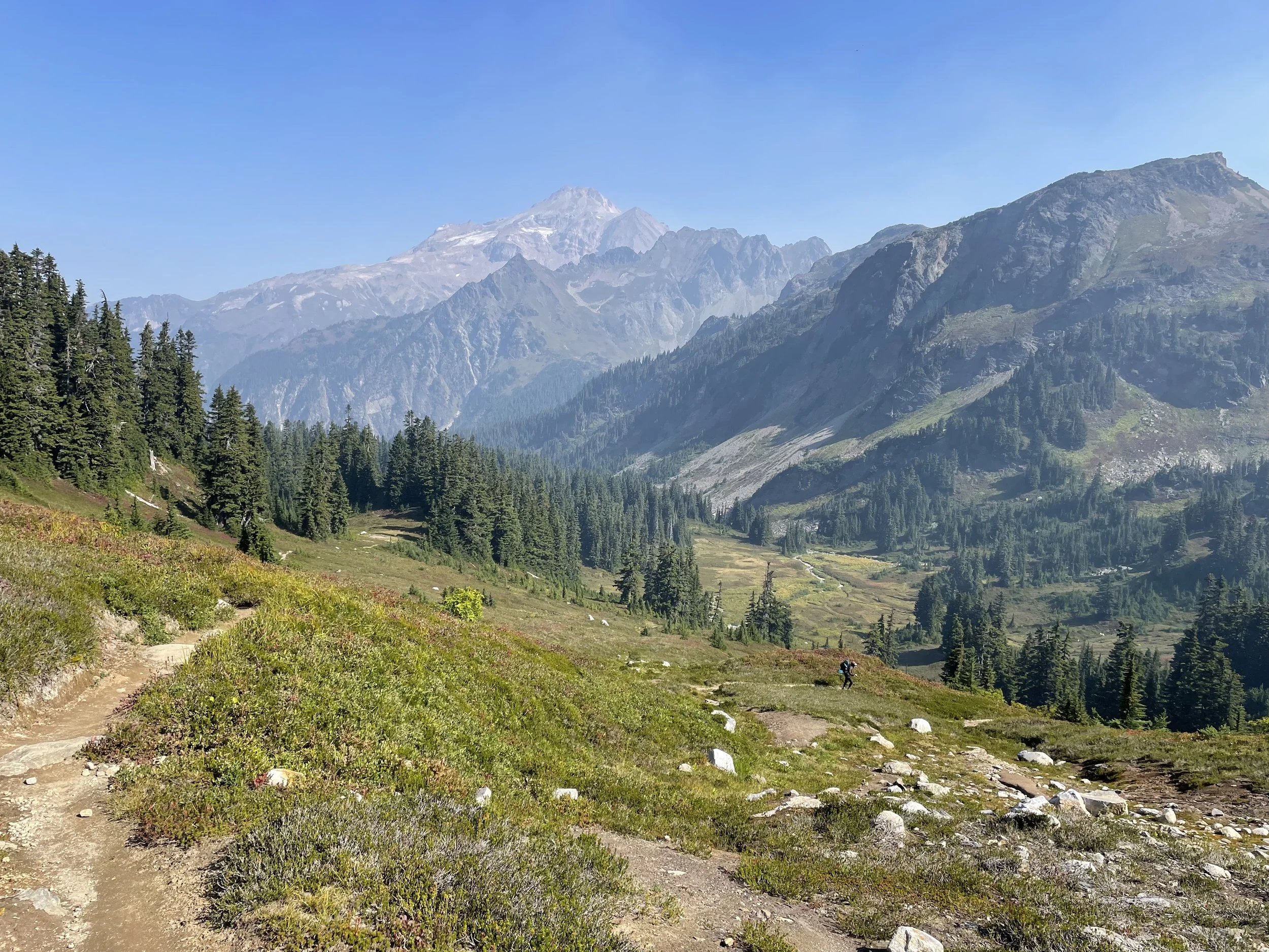
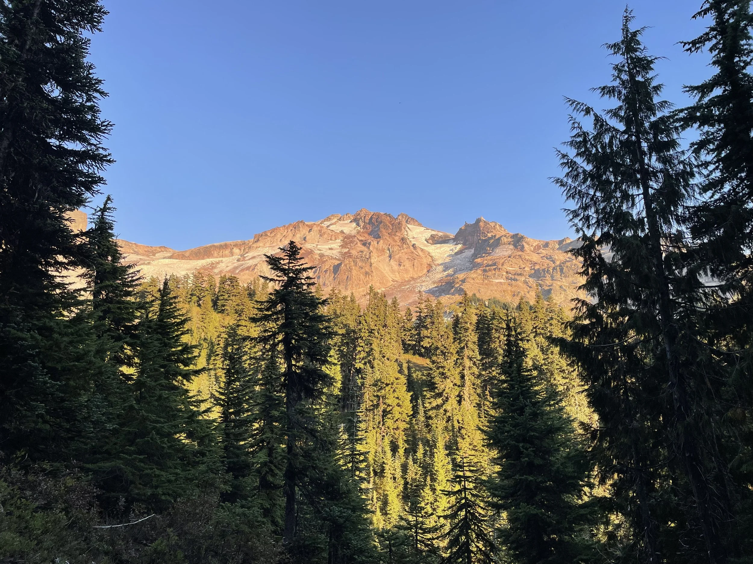
After that we walked through some beautiful meadows and then saw our first glimpse at Glacier Peak to the north. At 10,400 feet, it rose up out of nowhere and graced us with its incredible presence. We felt as though we were in Switzerland because of the views. It’s really wonderful knowing we have beauty like this right here in the United States.
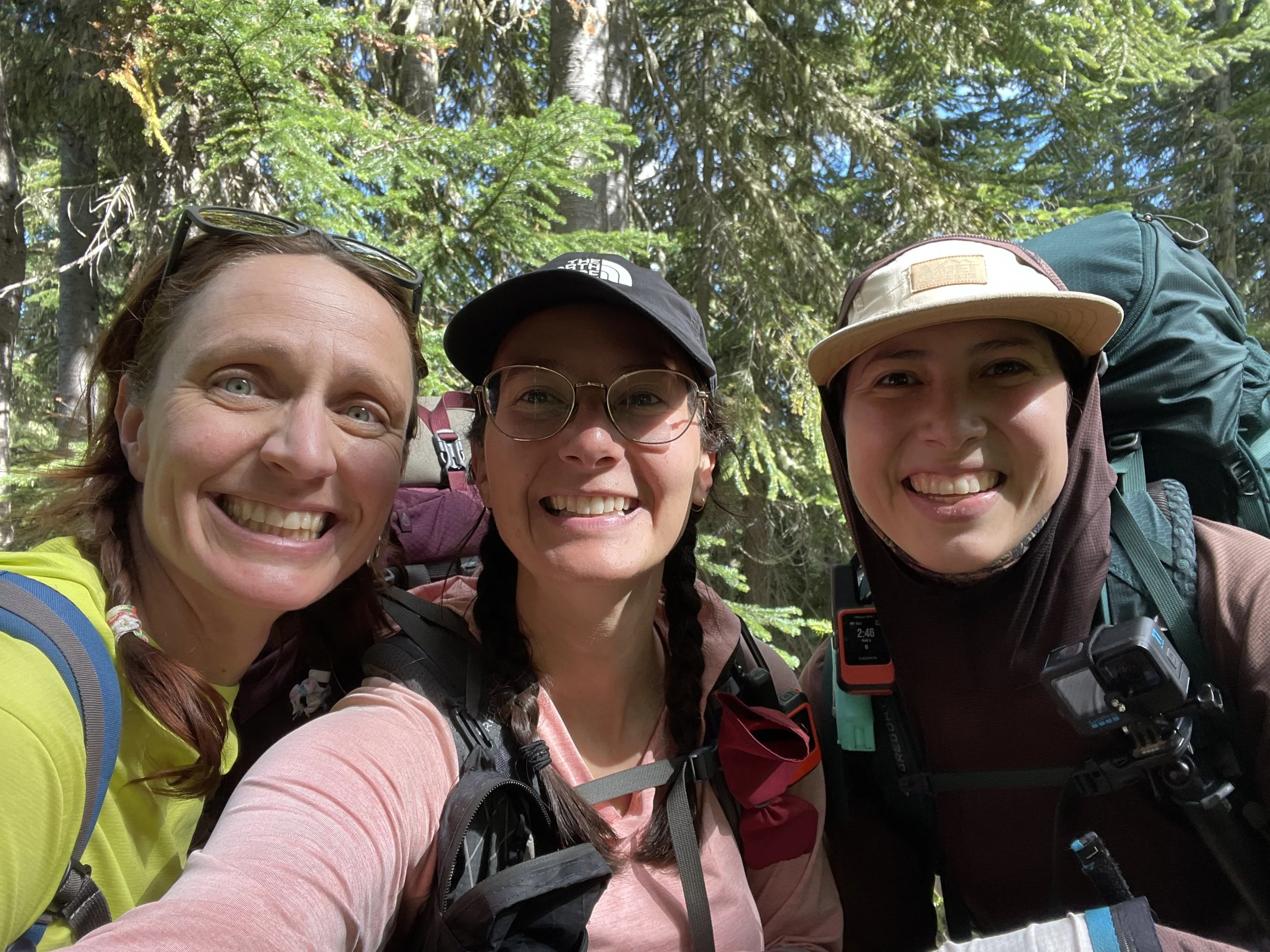
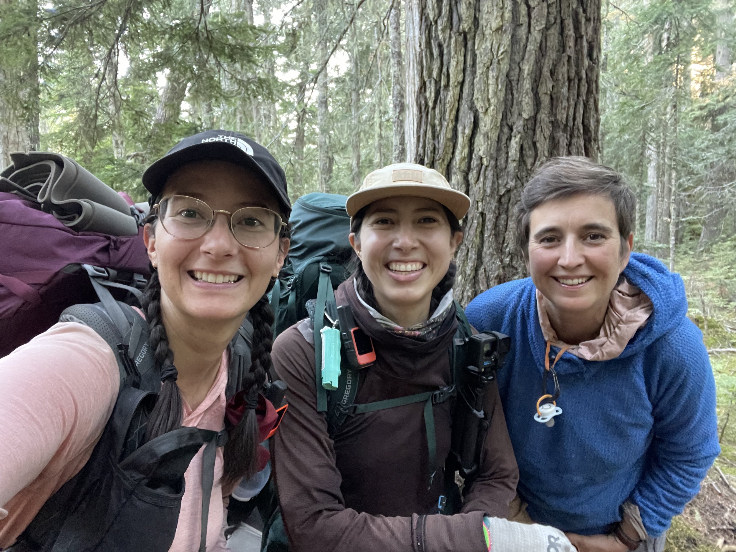
We continued on, dried out our tents and ground sheets at “second breakfast” and then later at lunch time we ran into Ariel. I bumped into her way back in Snoqualmie Pass and haven’t seen her since. I’m so glad we finally caught up to her, because with the fire closure coming up, it will be comforting having a small group of us navigating it, rather than just me and Zip.
A few miles before camp, we all had cell service, and I was able to call Erich and talk to him about the closure coming up. It was really nice to hear his voice. I love him so much, and can’t believe I get to be home with him in less than 2 weeks.
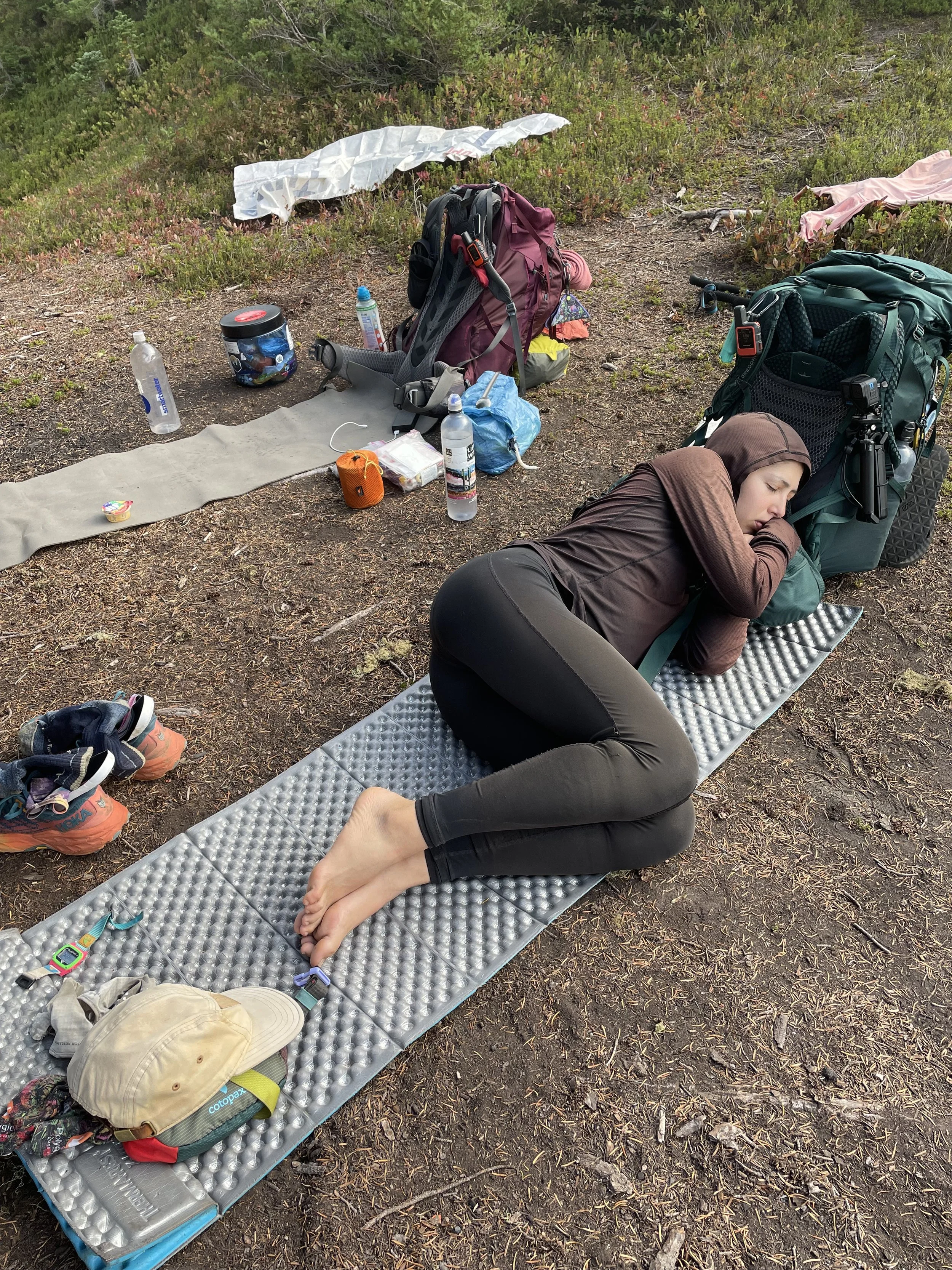
At camp now at Sally Ann Lake. We all had dinner together in a small meadow looking out at the lake, and it was nice to have conversation and enjoy the company as the sun disappeared and it grew dark. Always lovely to be in a group of women, especially out here when there can be a macho culture among some of our male thru-hiking colleagues. Had beef ramen and a chicken packet for dinner, but I definitely could have eaten more if I wasn’t rationing my food. I have about 5 days worth of food left now, and maybe will have a little extra for the day walking into Stehekin. I should be ok though. Going to ration for the next couple of days, and then I’ll be able to more easily tell how much I can eat each day once we’re closer to town.
Enjoying all of the views so much - Washington continues to inspire me. I feel like I’m walking through a painting, and all of my photos could never capture the spectacular beauty I see before me. What a place. It moves me.

Mile 2505.2 (kinda)
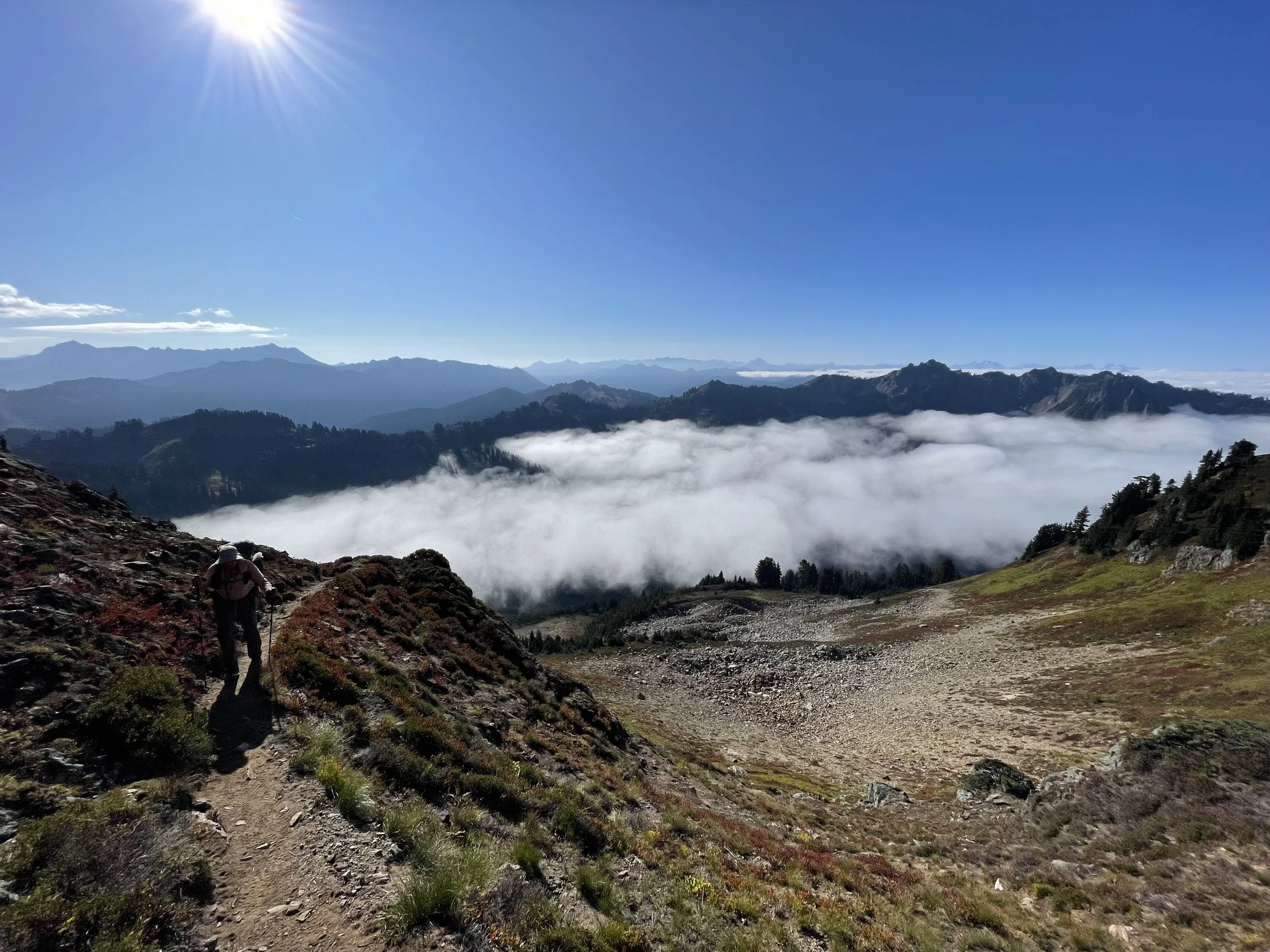
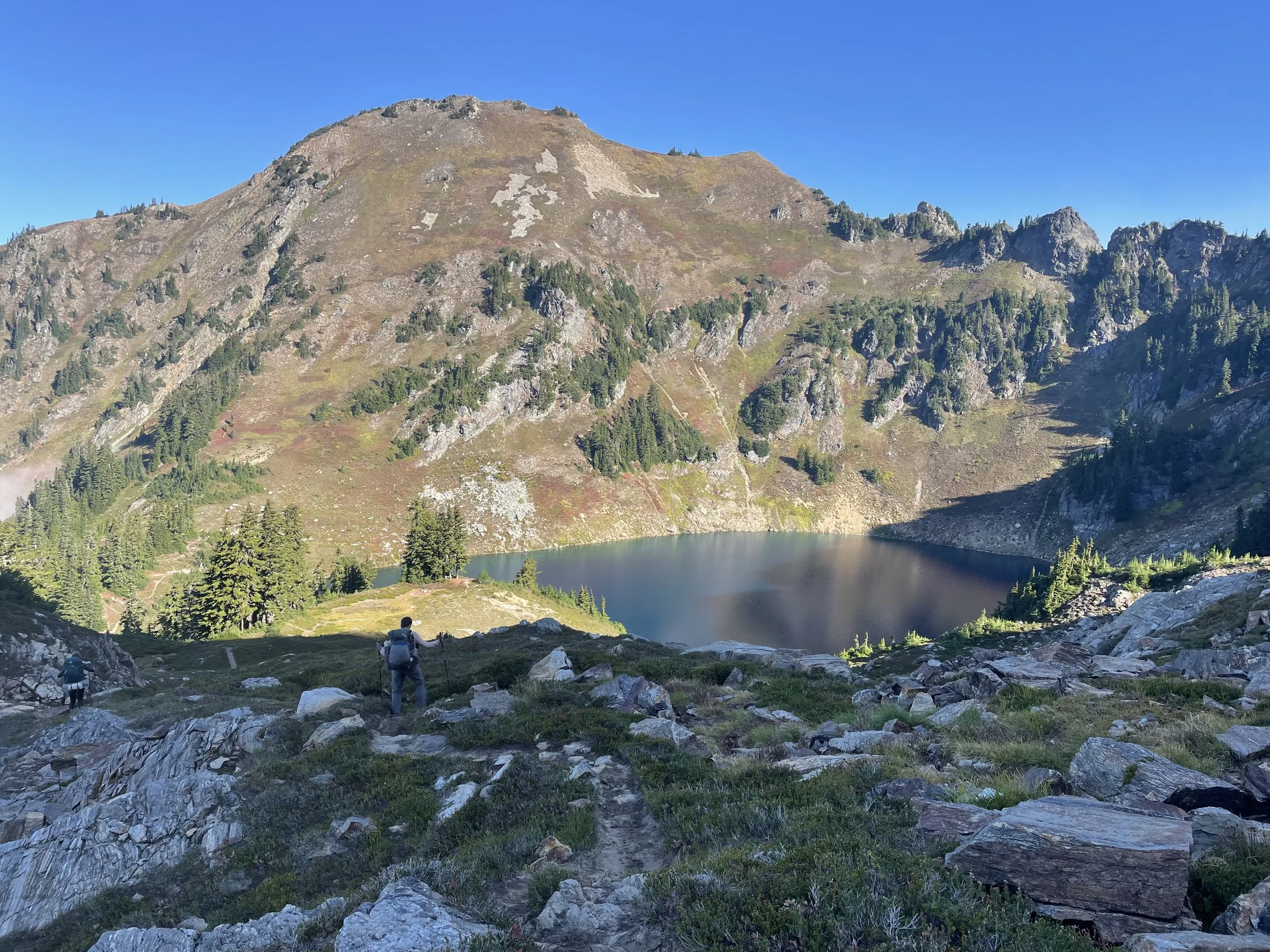
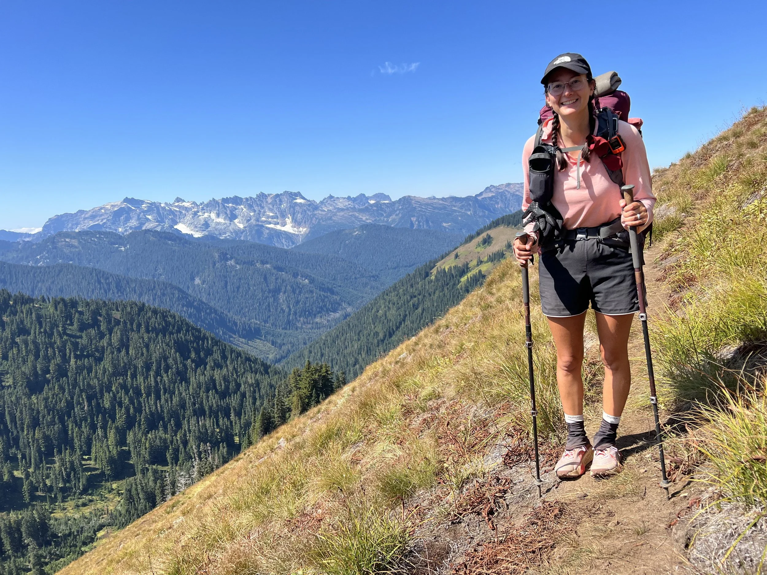
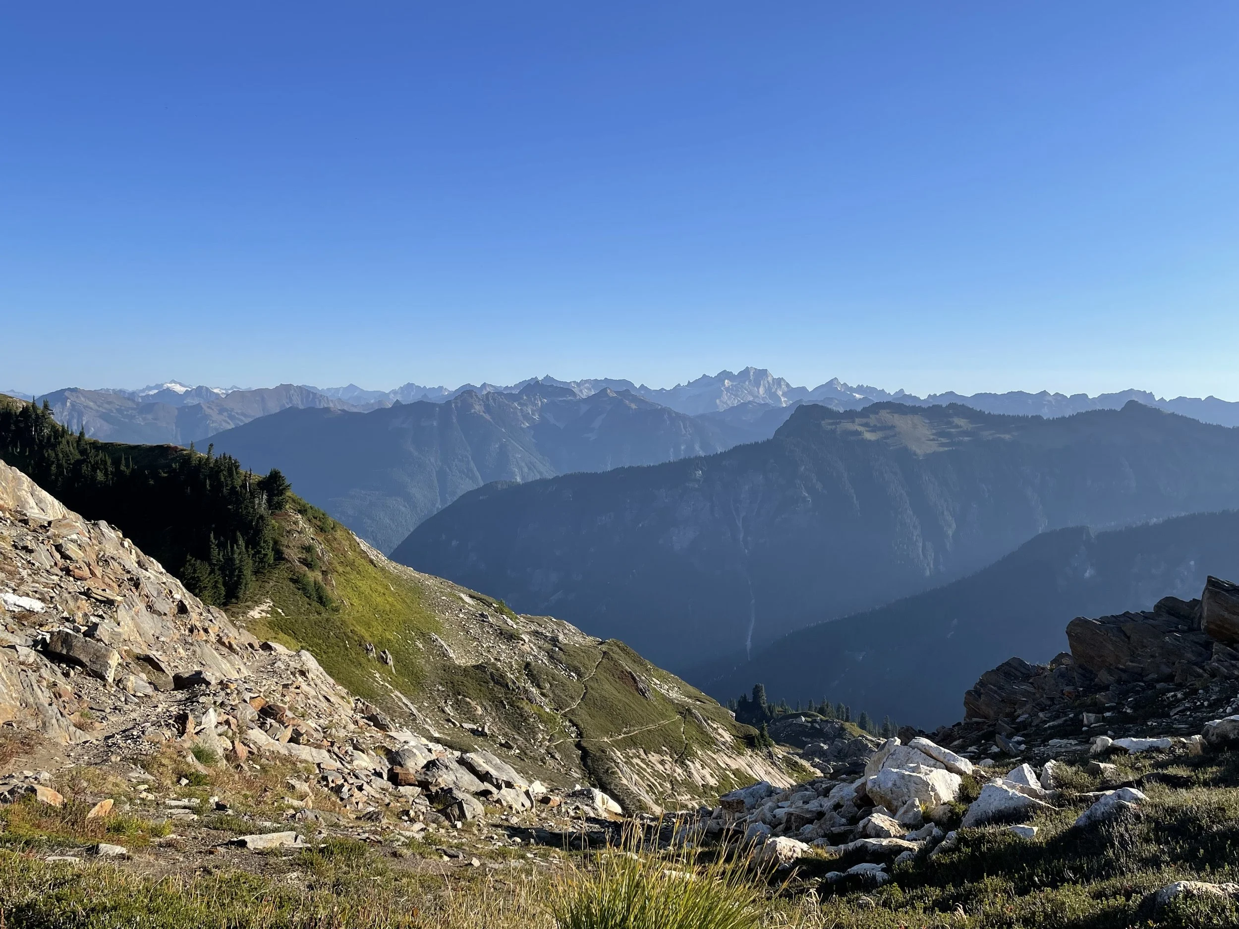
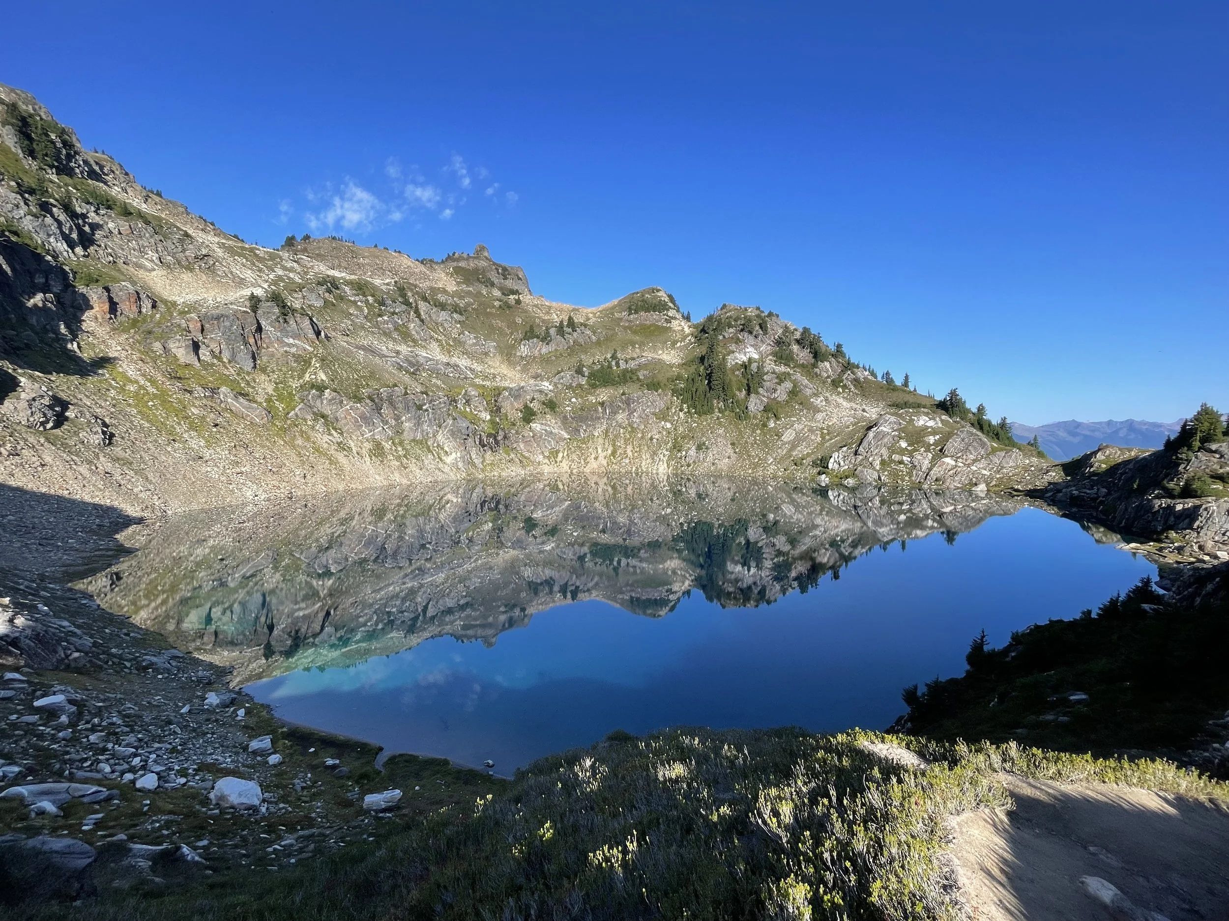
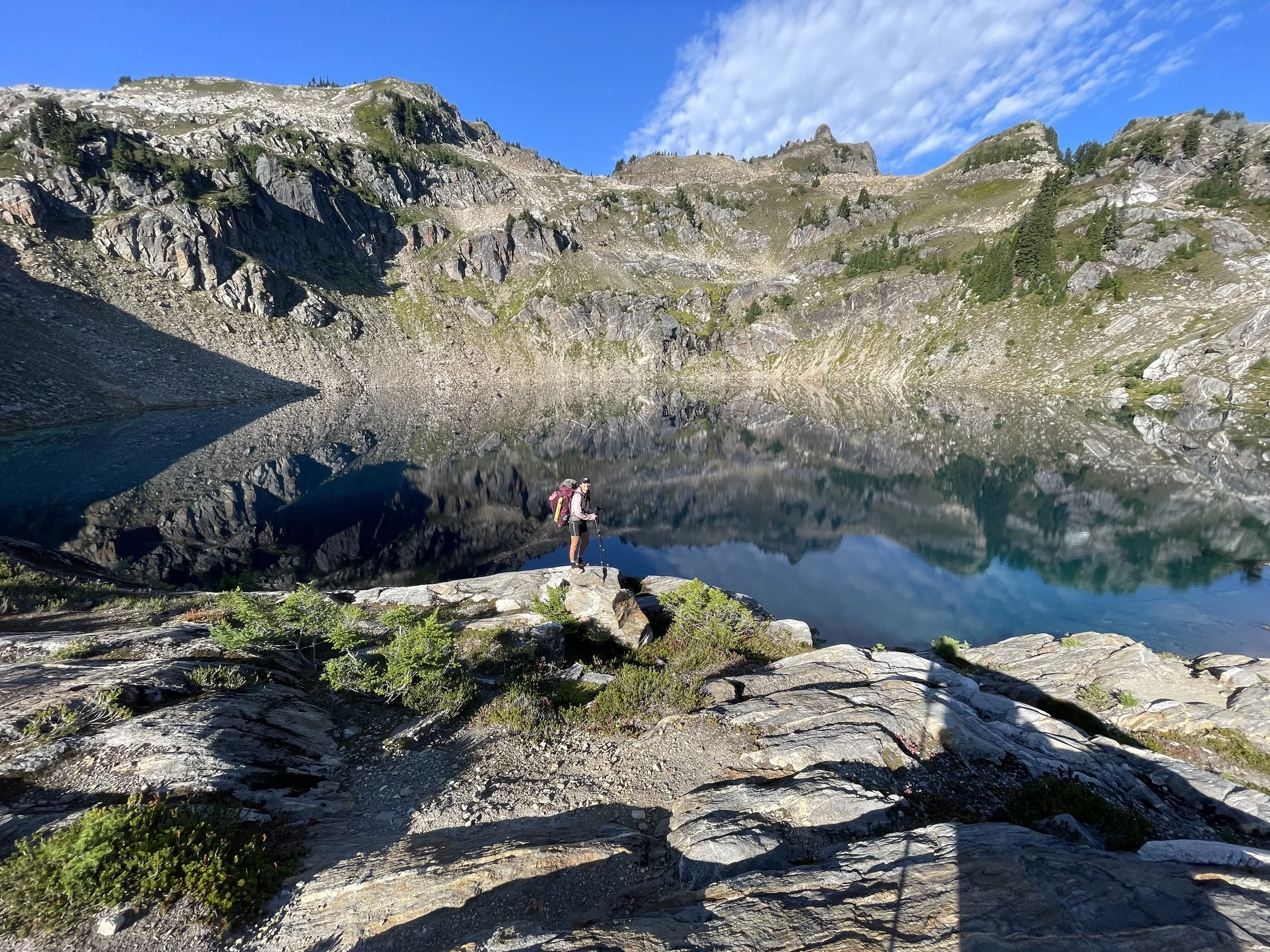
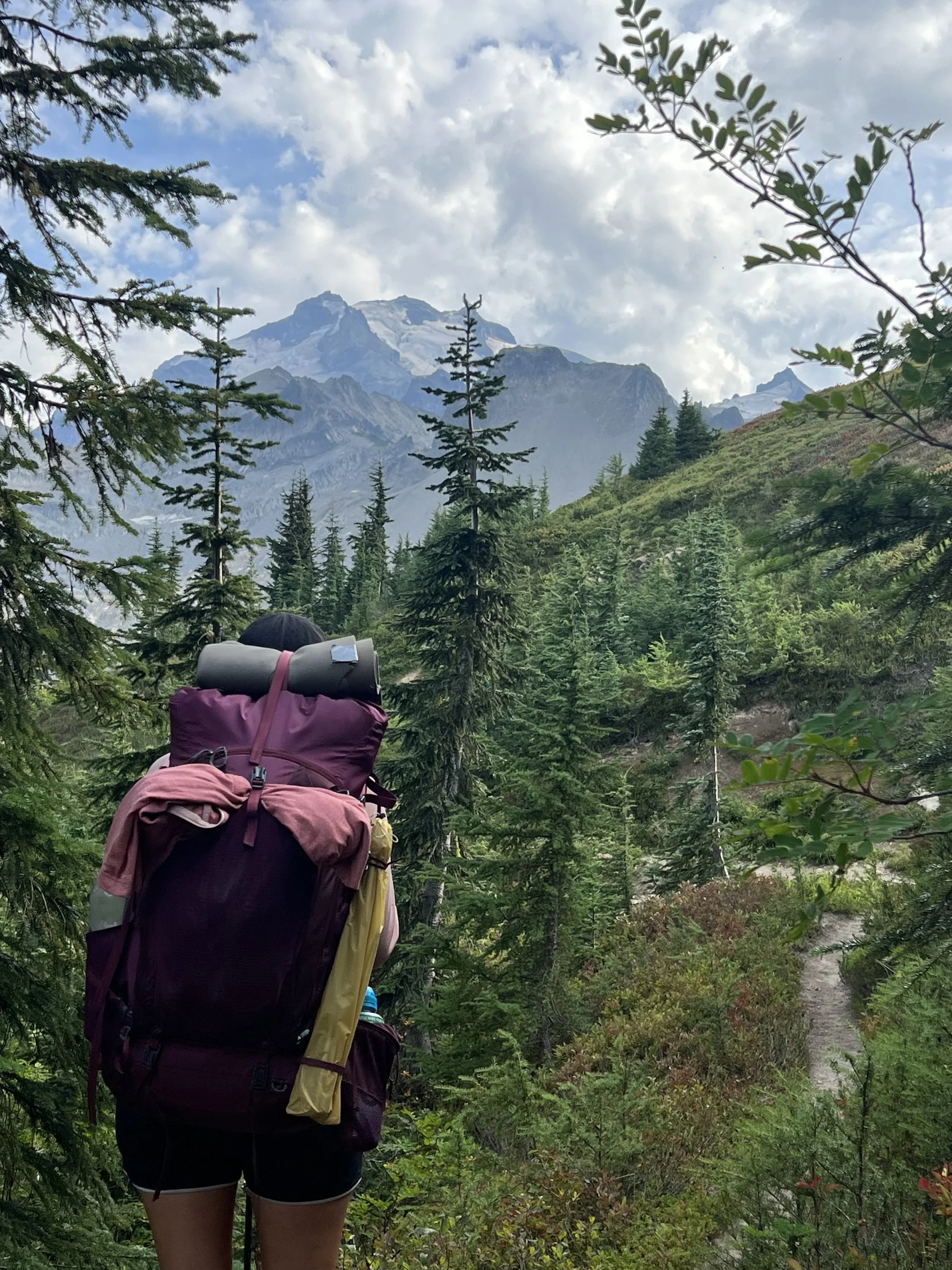
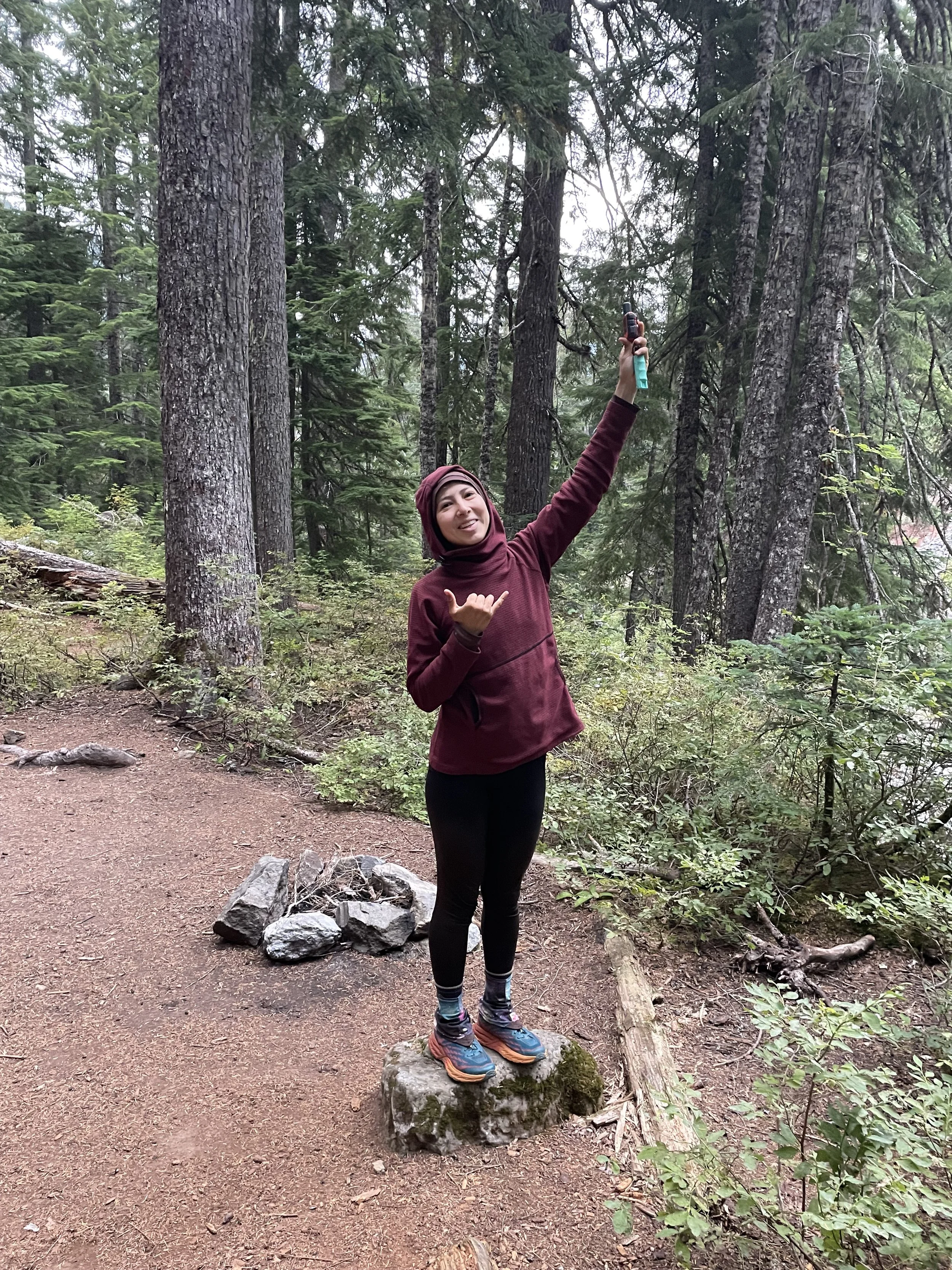
Currently on the Airplane Lake Fire alternate route. We hiked 2 miles to the southern end of the closure this morning and went off on the alternate. The PCT itself is only about 7-8 miles from the southern end of the closure to the northern end, but to go around it we have to take this 17-mile alternate trail which includes about 6,000ft of descent and 6,000ft of gain. It started out with an incredibly steep climb up and over a rocky ridge to get us to Blue Lake. It was very difficult, and I can imagine that in rainy weather it would border on dangerous. It was incredibly beautiful though, and we could see Mt. Rainier in the distance which we haven’t seen in multiple weeks.
Blue Lake was incredible, and I found myself wishing I could just camp there for days, enjoying the beautiful scenery. The water was crystal clear, and we even saw rainbow trout swimming.
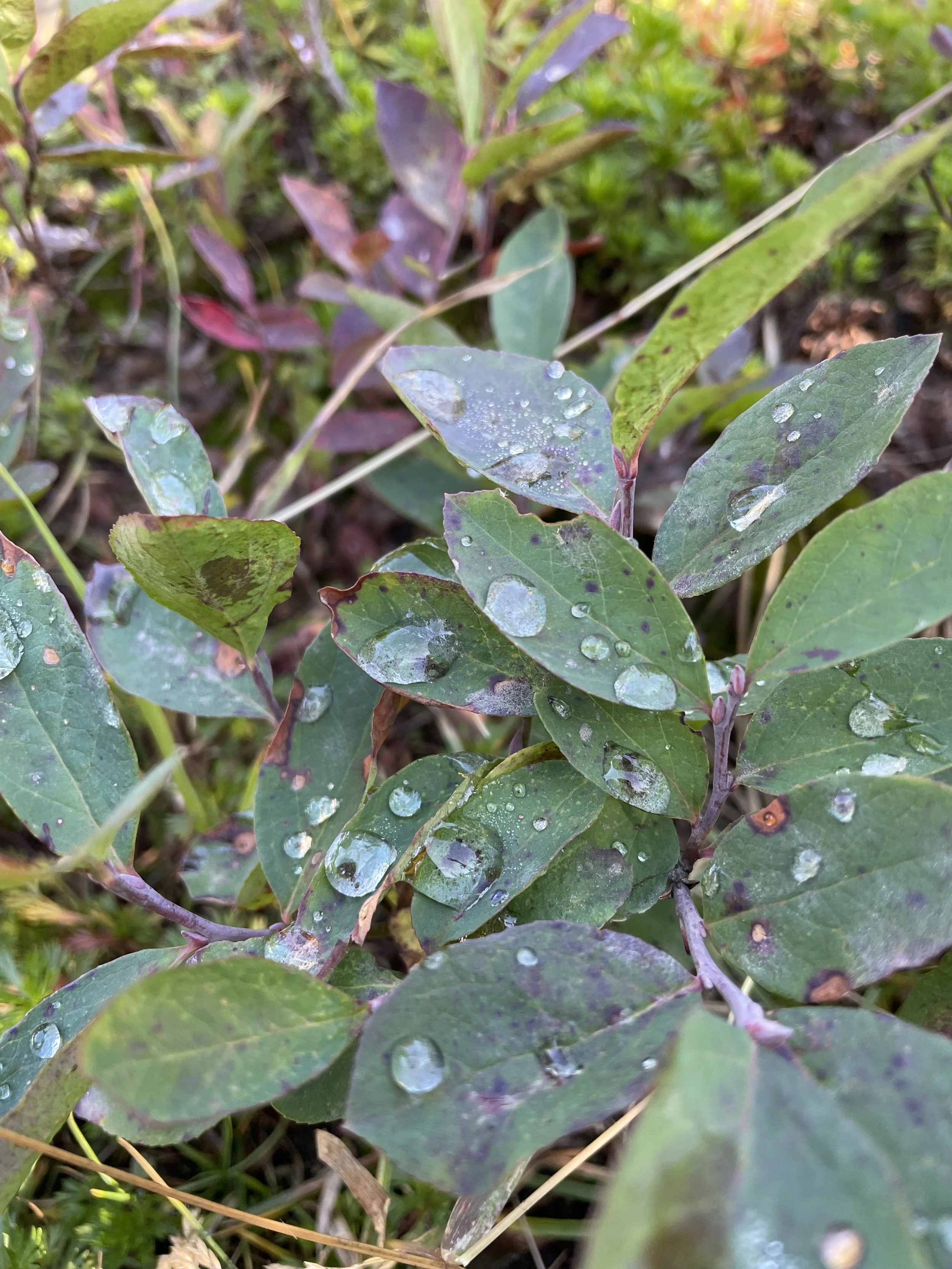
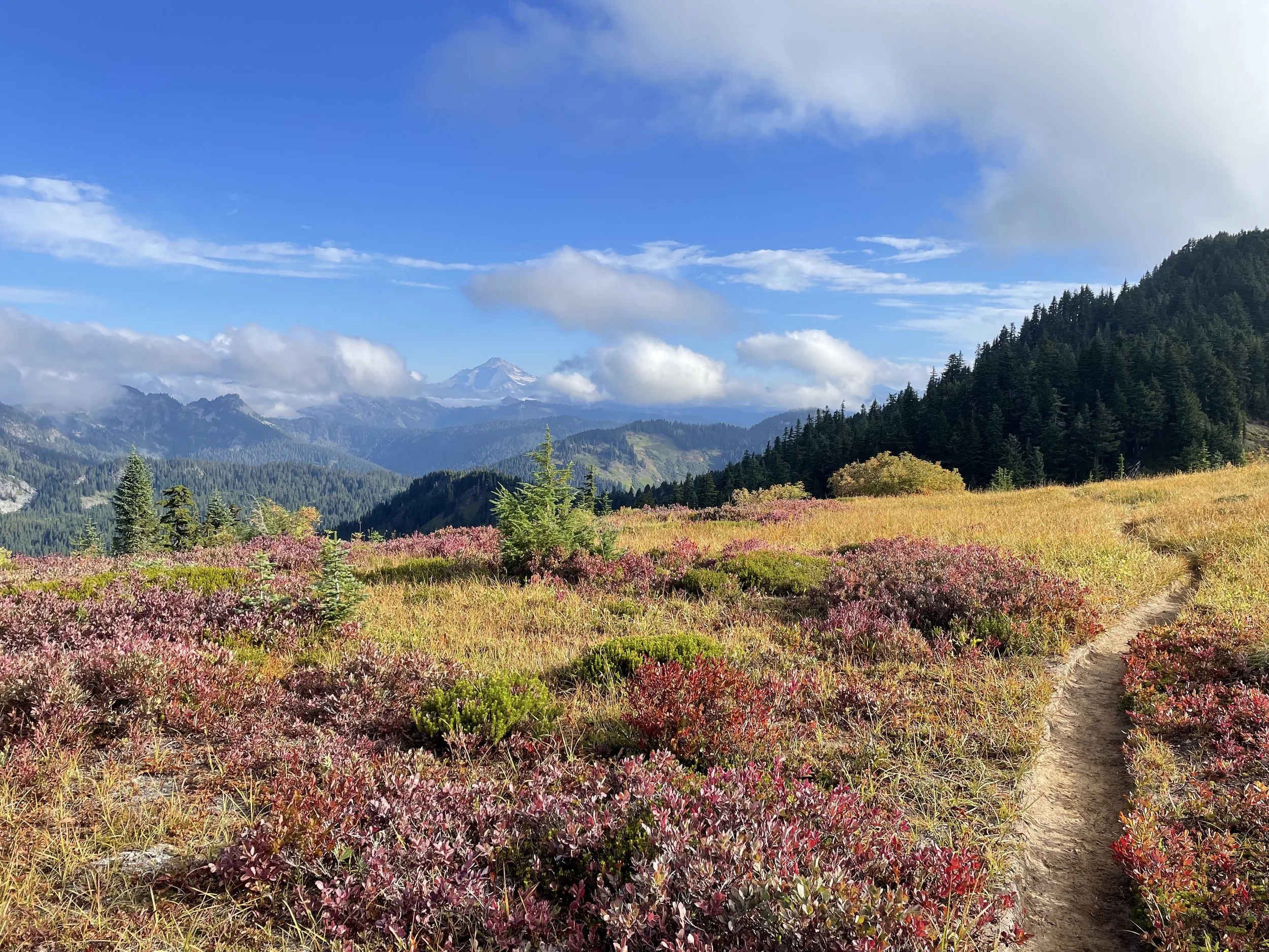
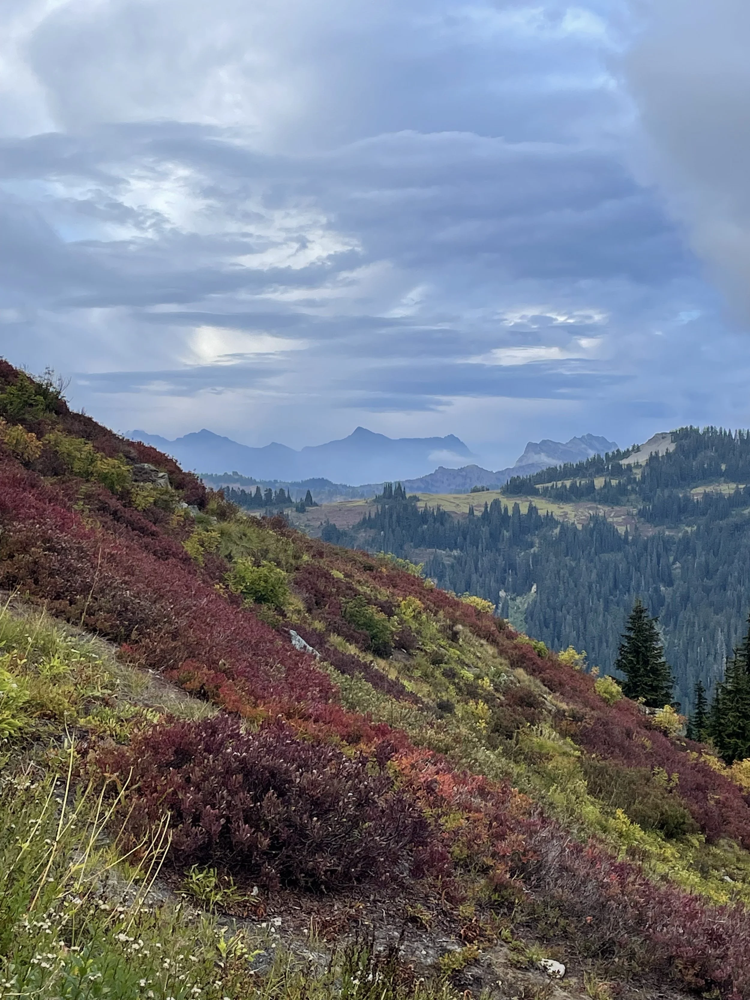
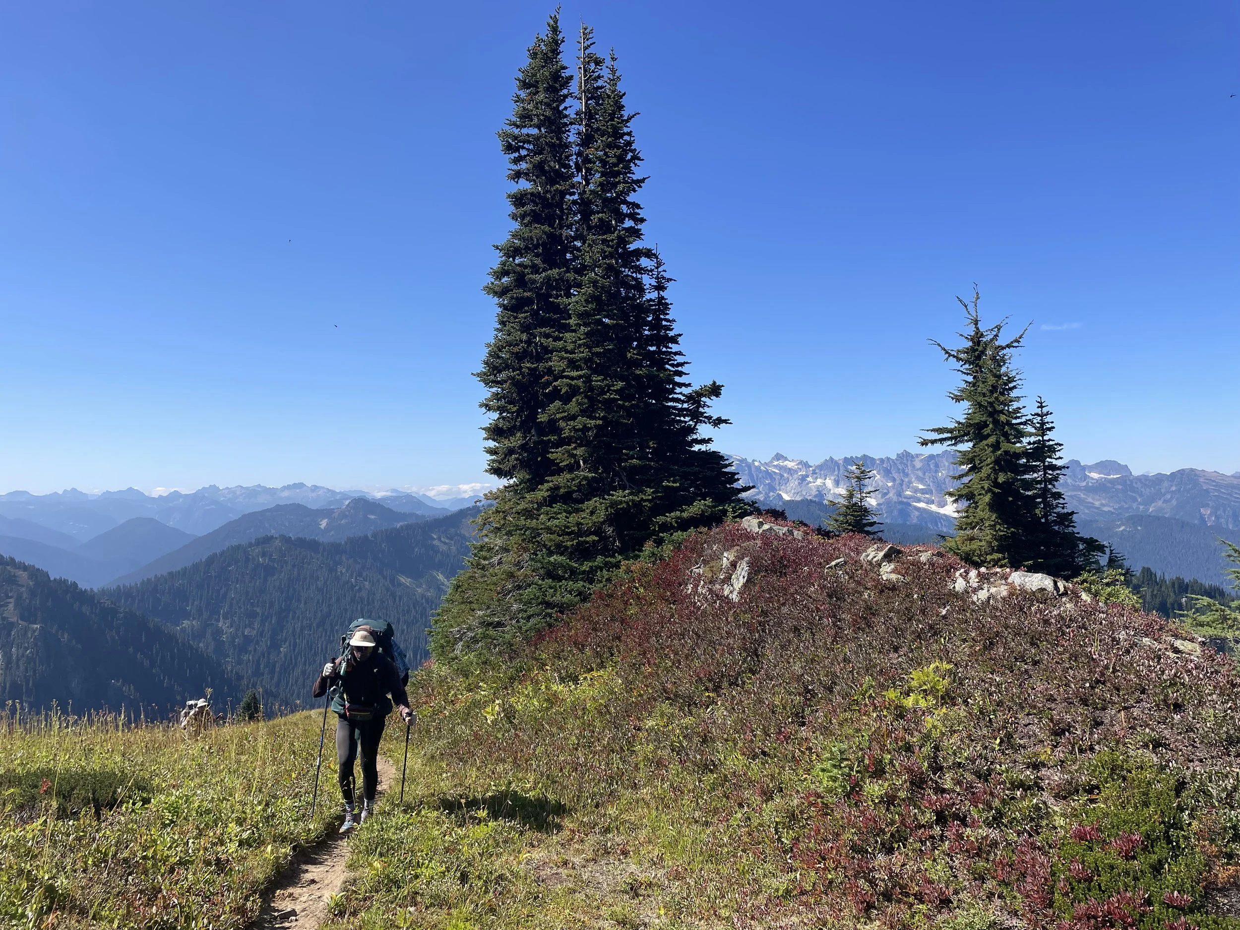
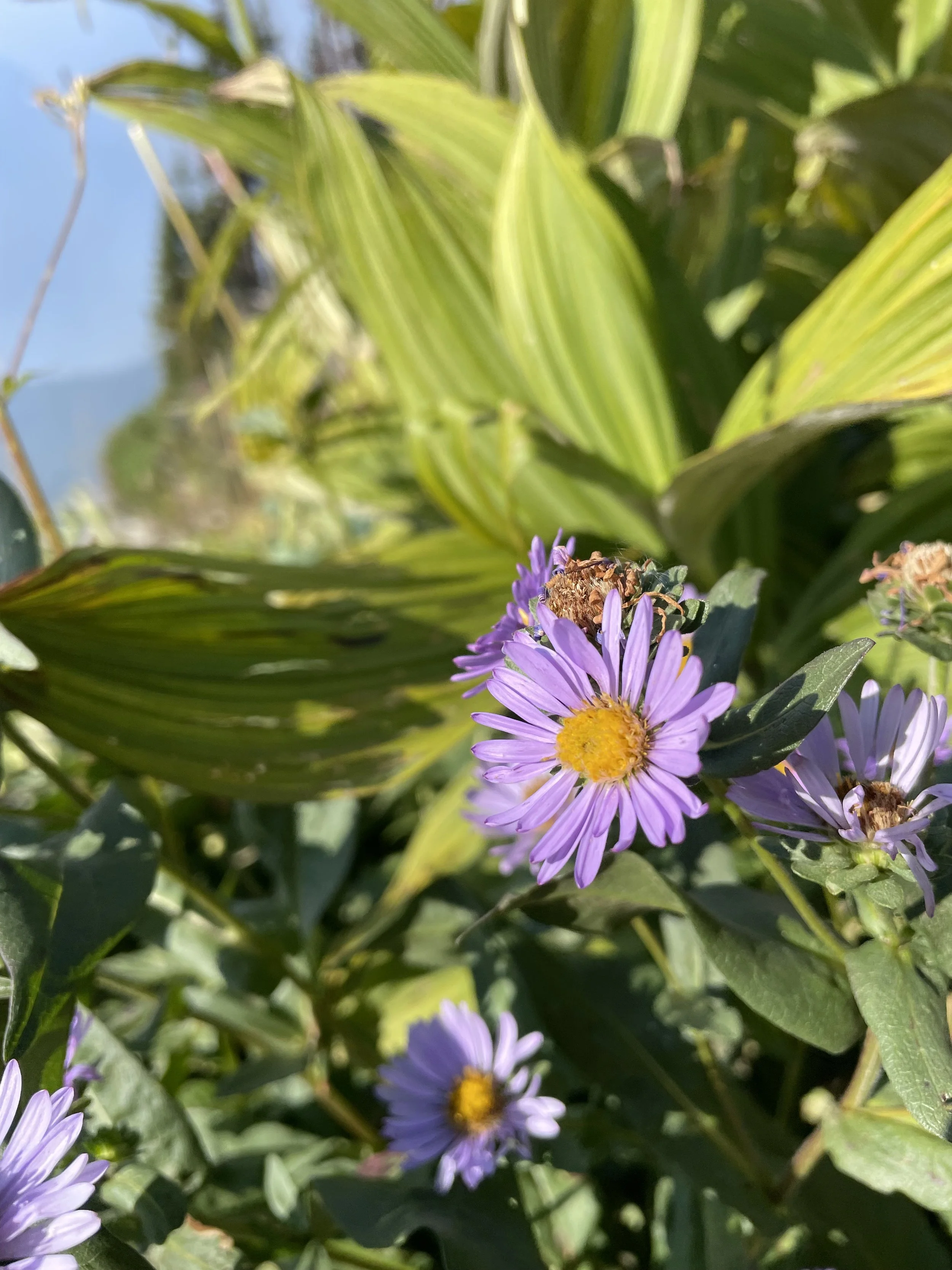
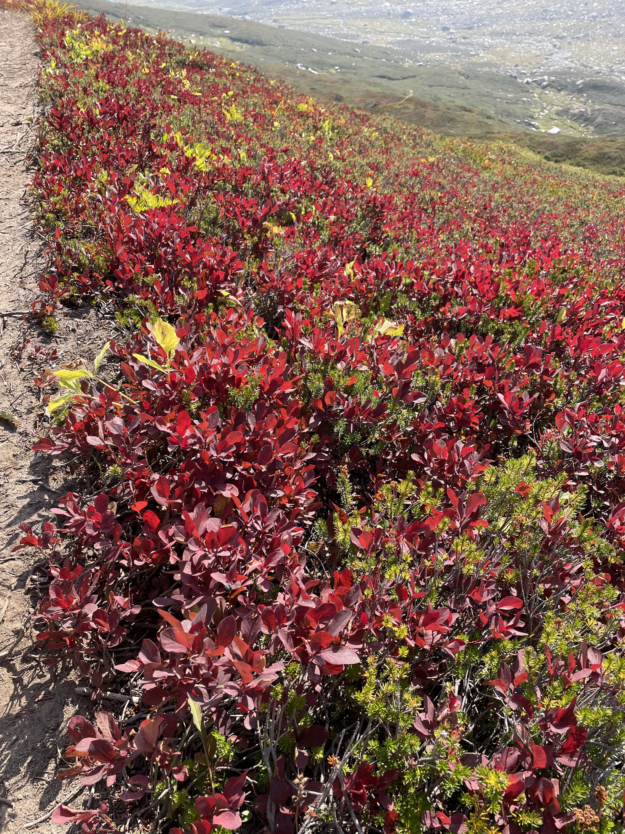
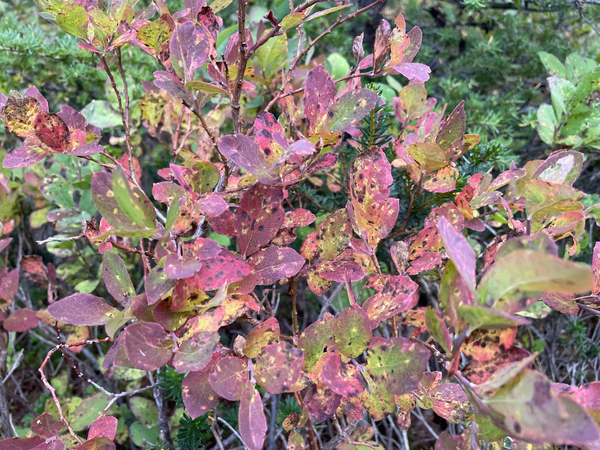
After having second breakfast there, we continued on to the most beautiful ridge walk I may have ever done. The mountains in the distance continued for miles, and several peaks and ridgelines rose up to greet us. The ridge we were hiking was covered in blueberry bushes turning purple and red, and against the kelly green vegetation the colors were breathtaking. Once again, The Sound of Music came to mind.
After more ridge-walking and getting views of Glacier Peak north of us (we’ll be rounding its base tomorrow and the next day) we had an intense descent of about 3000 ft over 2.5 miles. Our knees weren’t super happy, but all in all it was enjoyable. It’s been me, Ziploc, and Ariel. When we were almost to the bottom, a bee randomly stung me on my calf, which hurt like a bitch. I’m not allergic, but it still hurts now and it’s been around 5 hours. It’s not super painful, but still just throbs.
We pushed ourselves to get to the camp closest to the bottom of the 3000ft climb that is the end of this alternate. We’ll knock that tomorrow morning to get us back to the PCT. It’s over 3.5 miles, so it’s much better than the descent we had in terms of the grade. Hoping that’s true in real life.
Ziploc and I are both very concerned about the amount of food we have. We didn’t plan to be out for this many days since we didn’t know if we’d need to take the alternate or not. Stevens Pass didn’t have a grocery store or even a gas station, so we left with what we sent to ourselves in our resupply boxes and any leftover food from the previous stretch. We’re already rationing our supply, so we did some math and figured that if we can average 18 miles a day, we’ll get to the campground outside of Stehekin in 4 days. I think it’s doable, and even if we come up short, we can always hike 5-6 miles in the morning to get ourselves to town on the 5th day with minimal food in our bellies.
I’ve heard that we have some tough terrain on the way now that we’re in the Glacier Peak Wilderness, as well as a trail that isn’t maintained very well. I read that some areas haven’t seen trail maintenance in 3 years. Trying to go in with an open mind though, and take all that this experience has left for me. Hoping it’s mostly beautiful things and laughing with friends.


Mile 2520.5
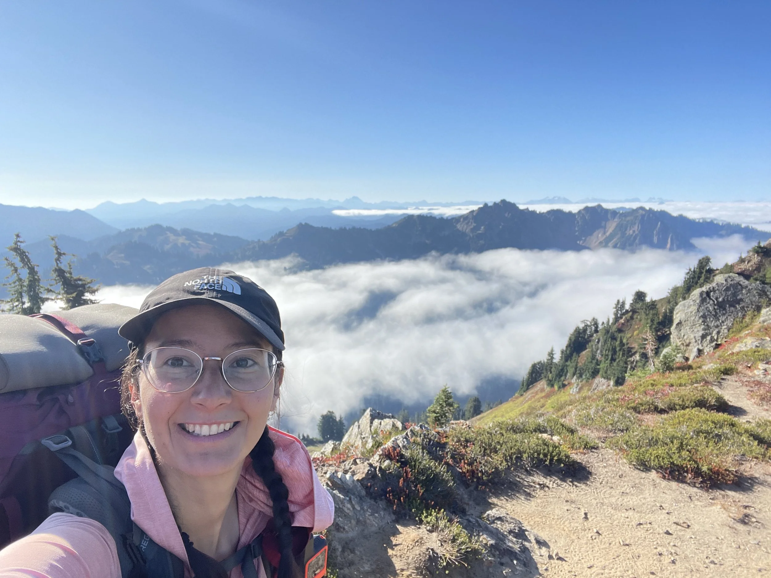
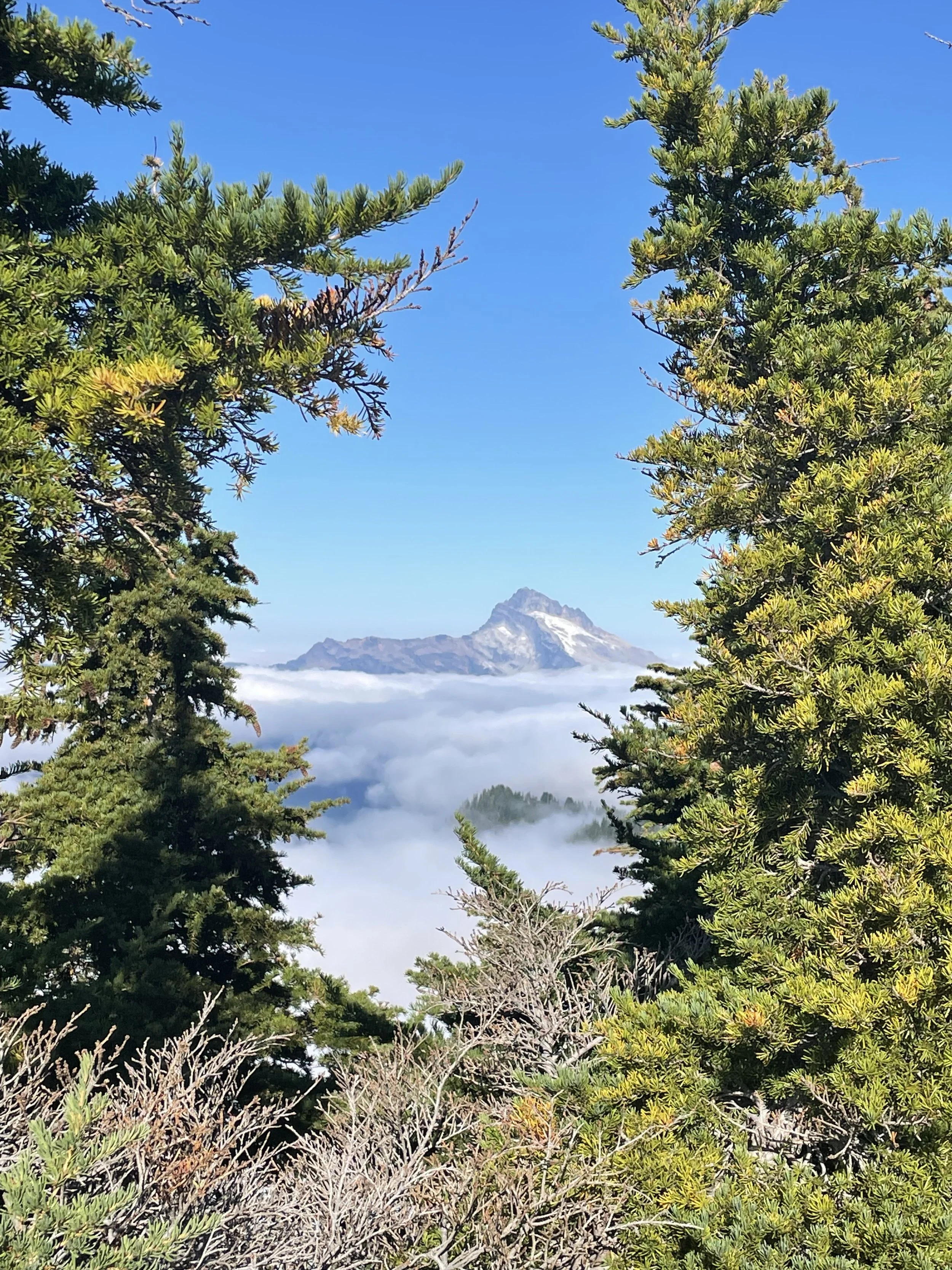
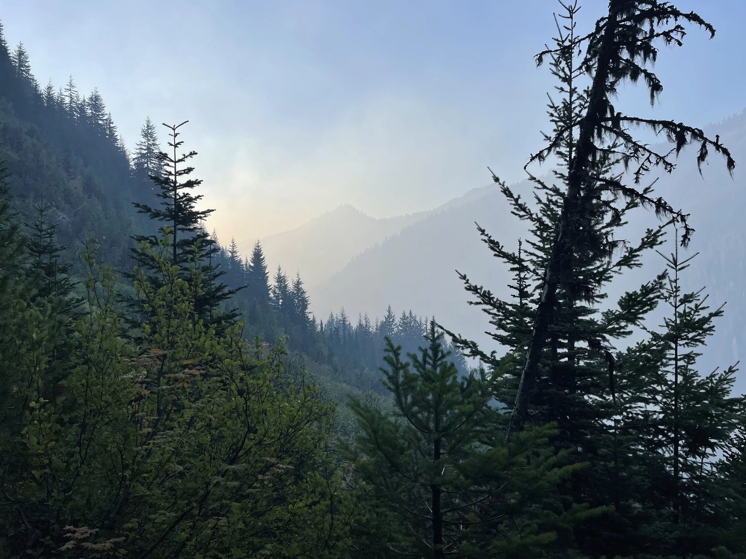
Today was another big day of lots of physical exertion. We started the day with the 3000ft climb to get us off of the alternate. As soon as I woke up this morning, I could smell smoke from the wildfire, and as we gained elevation we started to see a totally different valley from what we descended into yesterday. Visibility wasn’t great, the wind had changed direction and was blowing the smoke directly toward us. As we climbed, the air got slightly better, but the smoke made the climb that much harder on the lungs.
When we finally made it to the top, it felt so good. That was an incredibly beautiful alternate, but it was probably the most physically challenging trail I’ve encountered. It makes me appreciate and finally understand what people say when they talk about the gentle grade of the PCT, even in Washington.
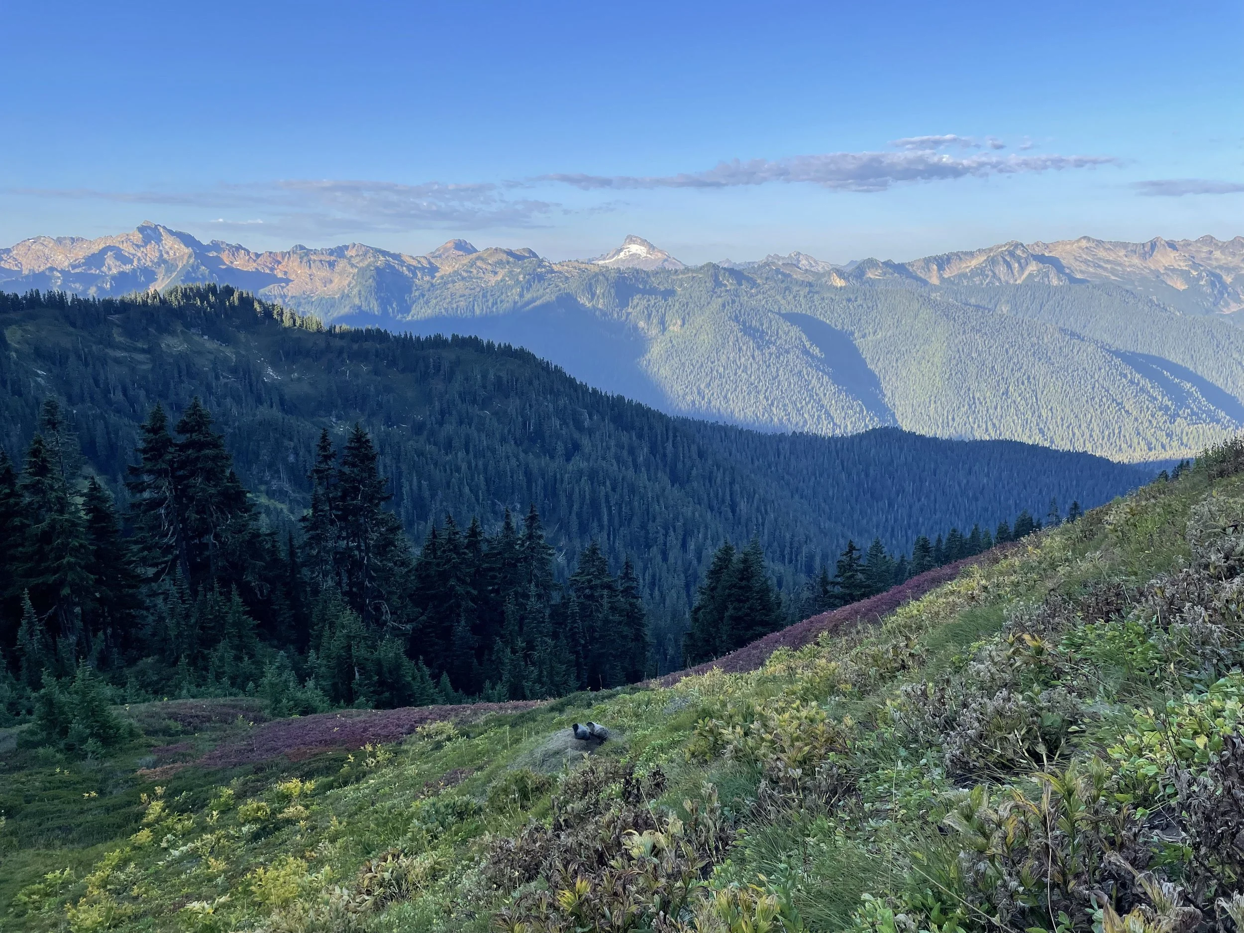
We continued on after taking a short break, and were welcomed with glorious views of Glacier Peak and the wilderness surrounding it. The meadows were heavenly with so many colors against the contrast of rock on the north face of the ridge we had come from. It’s been hard recently not to stop and take pictures every 5 minutes.
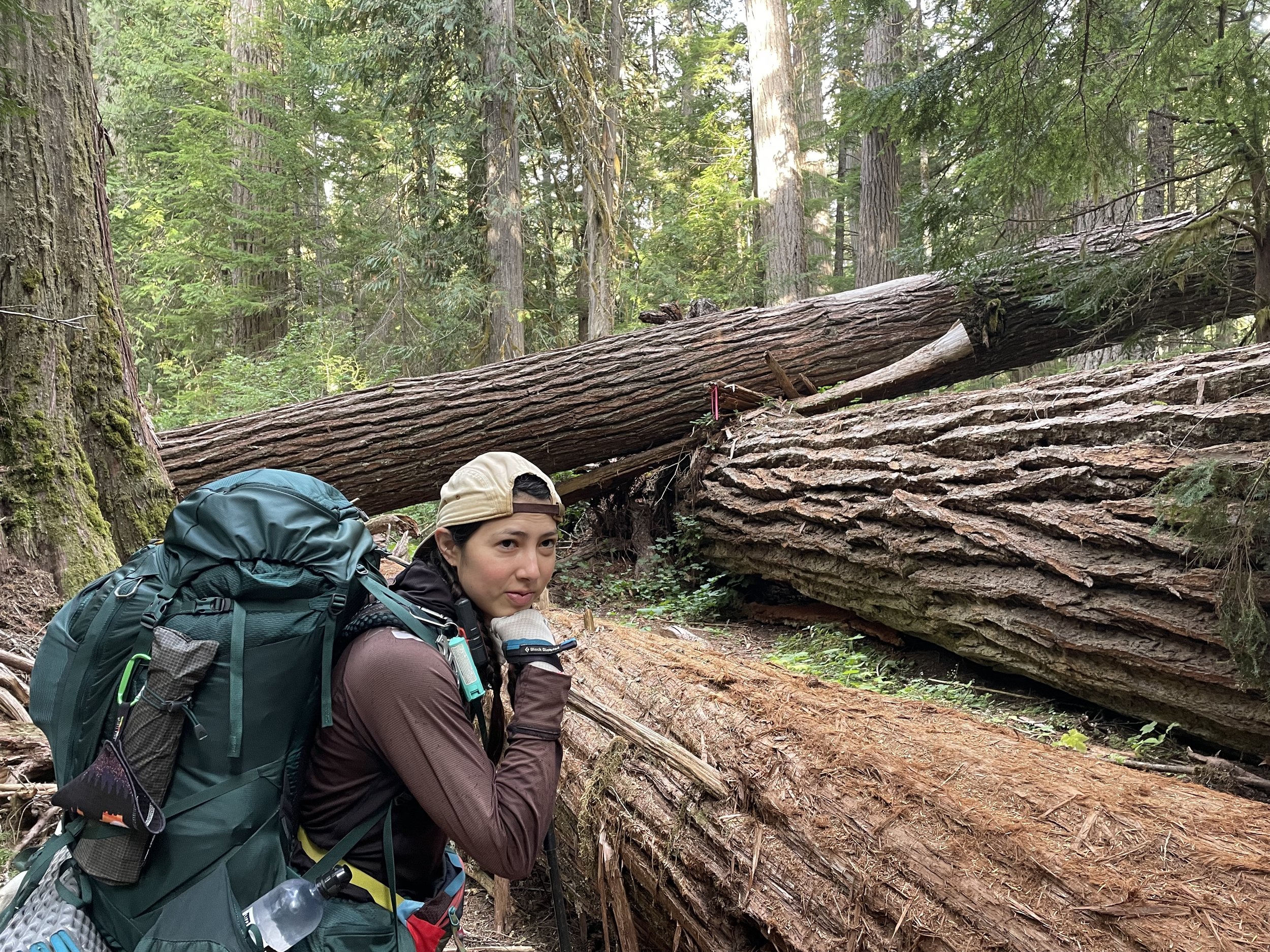
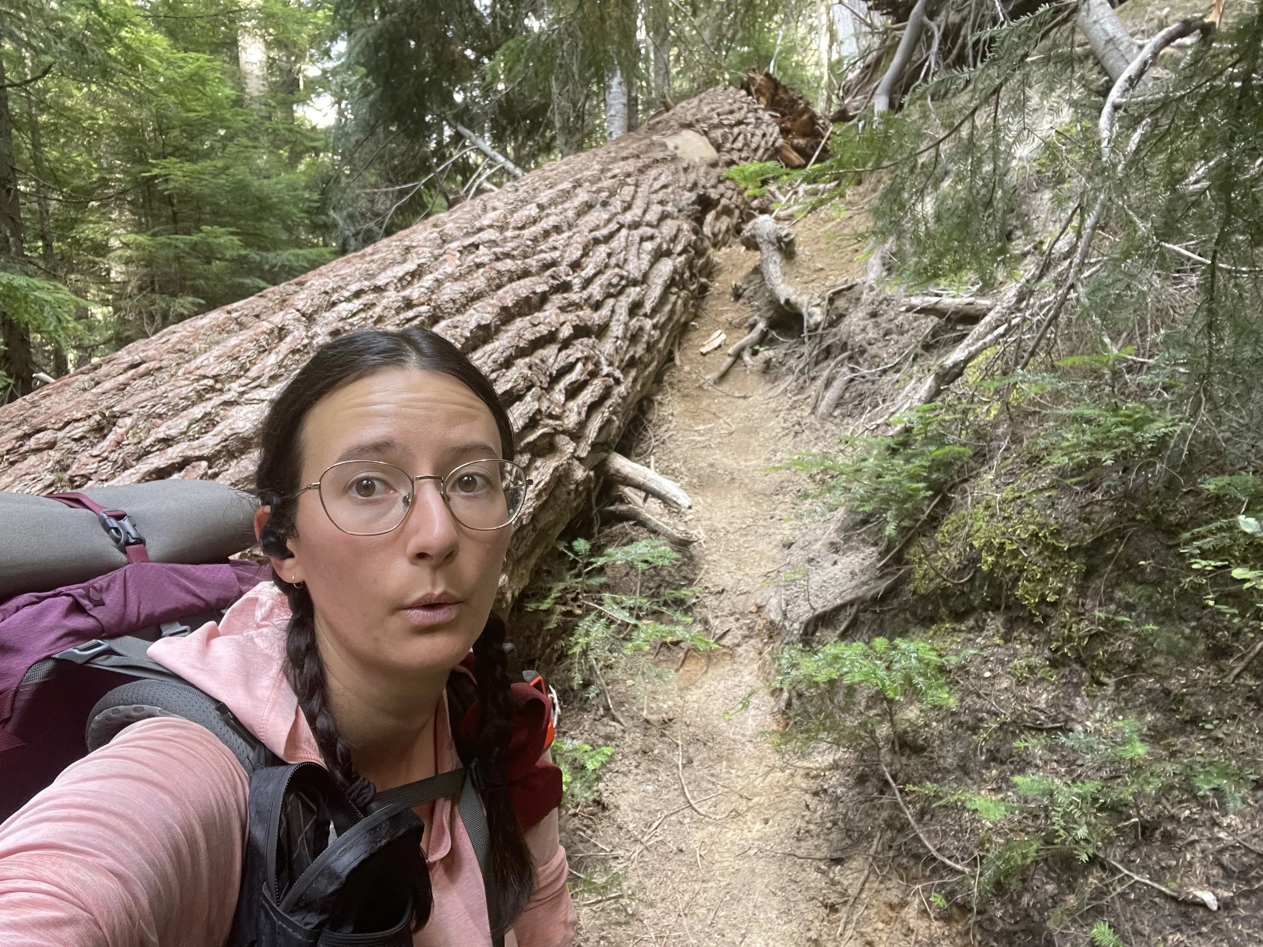
The rest of the day was really nice and we all had a good time walking together and making our way through some lovely forest. There were plenty of blowdowns which always makes things move slower, but luckily they weren’t too difficult to go over or around.
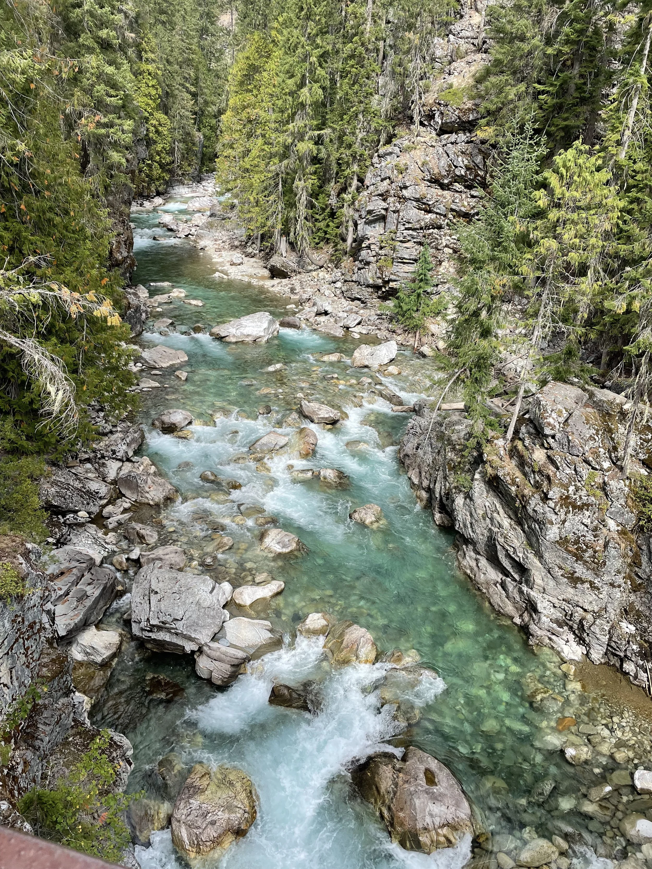
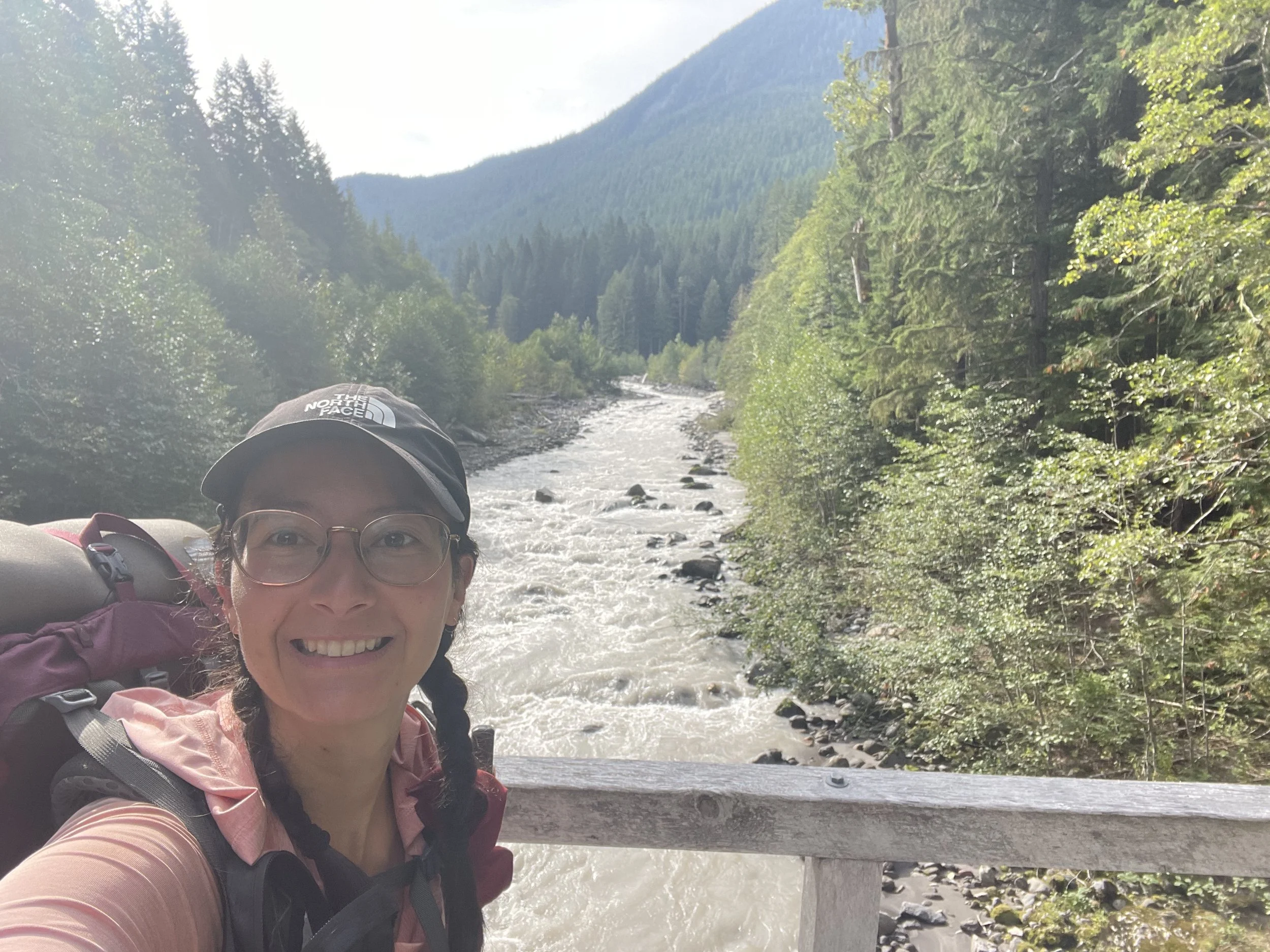
We arrived at Kennedy Creek around 4:30pm after having already been warned that we would need to cross in the water. (Crossing a river that is fed by, or partially fed by, smowmelt in the afternoon can be more dangerous as the water level will be higher. Overnight, the snow refreezes and so the water level is lower come morning.) We assessed our options of where to cross and decided it looked safe enough to move forward, so we prepped ourselves and our gear for the crossing. I put all of my extra clothing as well as a few electronics inside of a plastic dry bag, and then took off my socks and took out the insoles of my shoes. I tied my shoes very tight, because I remembered the last time I had to cross a river in the water my feet were slipping inside the shoes.
Ariel went across first and made it look quite easy, so I was feeling confident as I took my first few steps. At no point did I feel like I was in danger of falling in, but it definitely wasn’t an easy crossing. The water was extremely cold, and maybe even more difficult were all of the large rocks and logs underneath the surface. The water was full of silt so you couldn’t see anything below the surface. Rocks were awkward to step between and slippery, and logs meant having to take large steps over them which made it tougher to balance. When I got across, I experienced something I never had before. I stepped out of the water and my feet were so cold that I began to uncontrollably panic. I thought that I might need to immediately sit down and rip off my shoes. My heart started to pound, but as I looked for a spot to sit down, a few moments passed and it subsided. It was a little shocking and made me really mentally uncomfortable. I turned around to see Ziploc was already halfway across. We all made it without incident and then took a final snack break before continuing on. I was able to calm down a bit, and it felt good to complete our final river crossing of the trail.
Ariel decided to stop for camp after that, and it was hard to say goodbye! We really enjoyed hiking with her the last few days, she’s so sweet and funny, and has a very calming nature. I met her back in Crater Lake, so it was a wonderful full circle moment to get to hike a small section together on our last full stretch in Washington.
Ziploc and I decided to do 5.6 more miles to get us to 18 miles for the day. Because the morning’s climb had taken us around 2 hours, plus we took about a 30 minute break at the top, we’d lost about an hour of daylight from our day. We had to hike the last couple of miles with headlamps on in the dark, and it wasn’t necessarily an easy trail. We were on a steep ridge that had a washed out trail with overgrown vegetation, as well as large blowdowns and deadfall to clamber over. I’m proud of us that we kept on trucking and got through it, but it really tired us out.
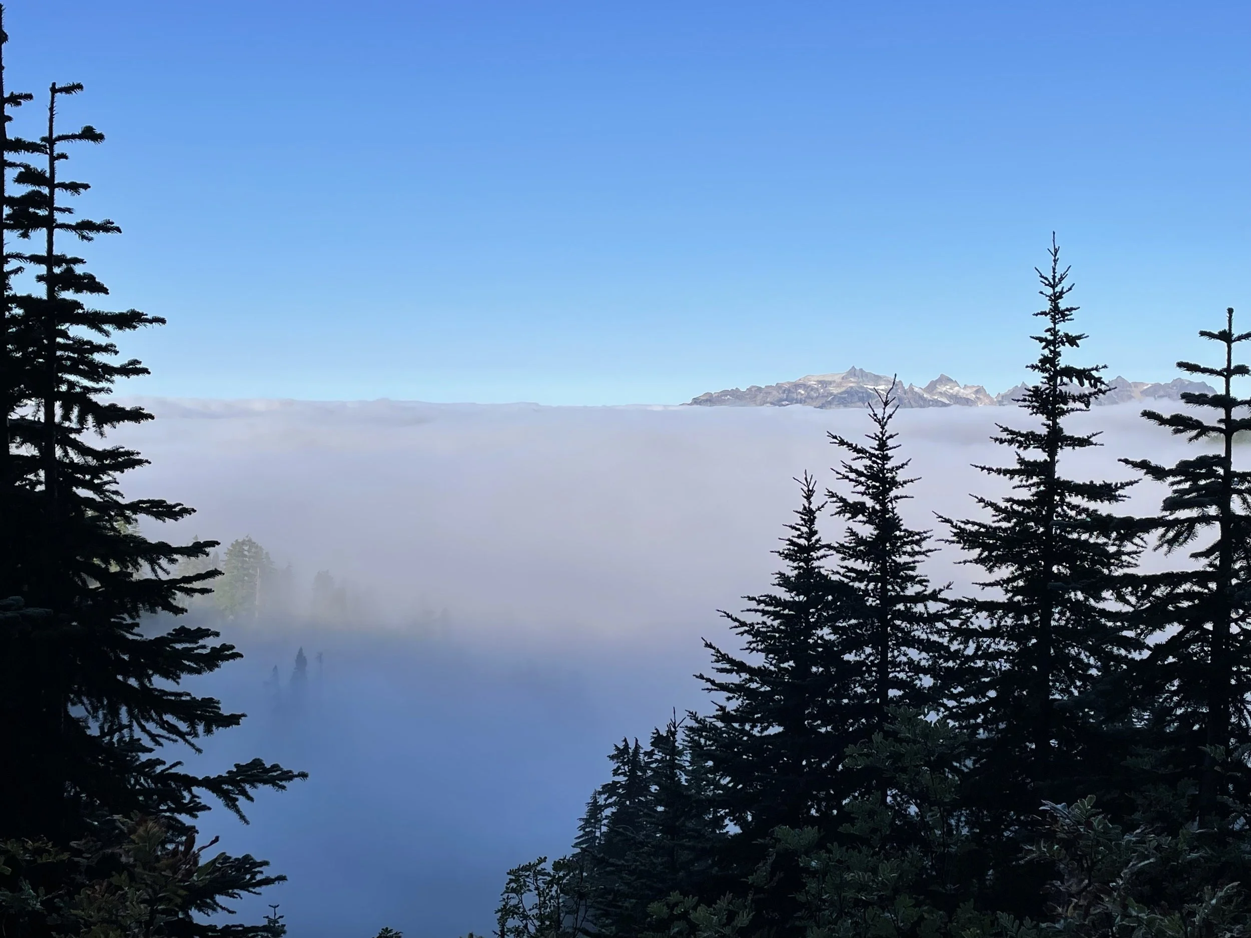
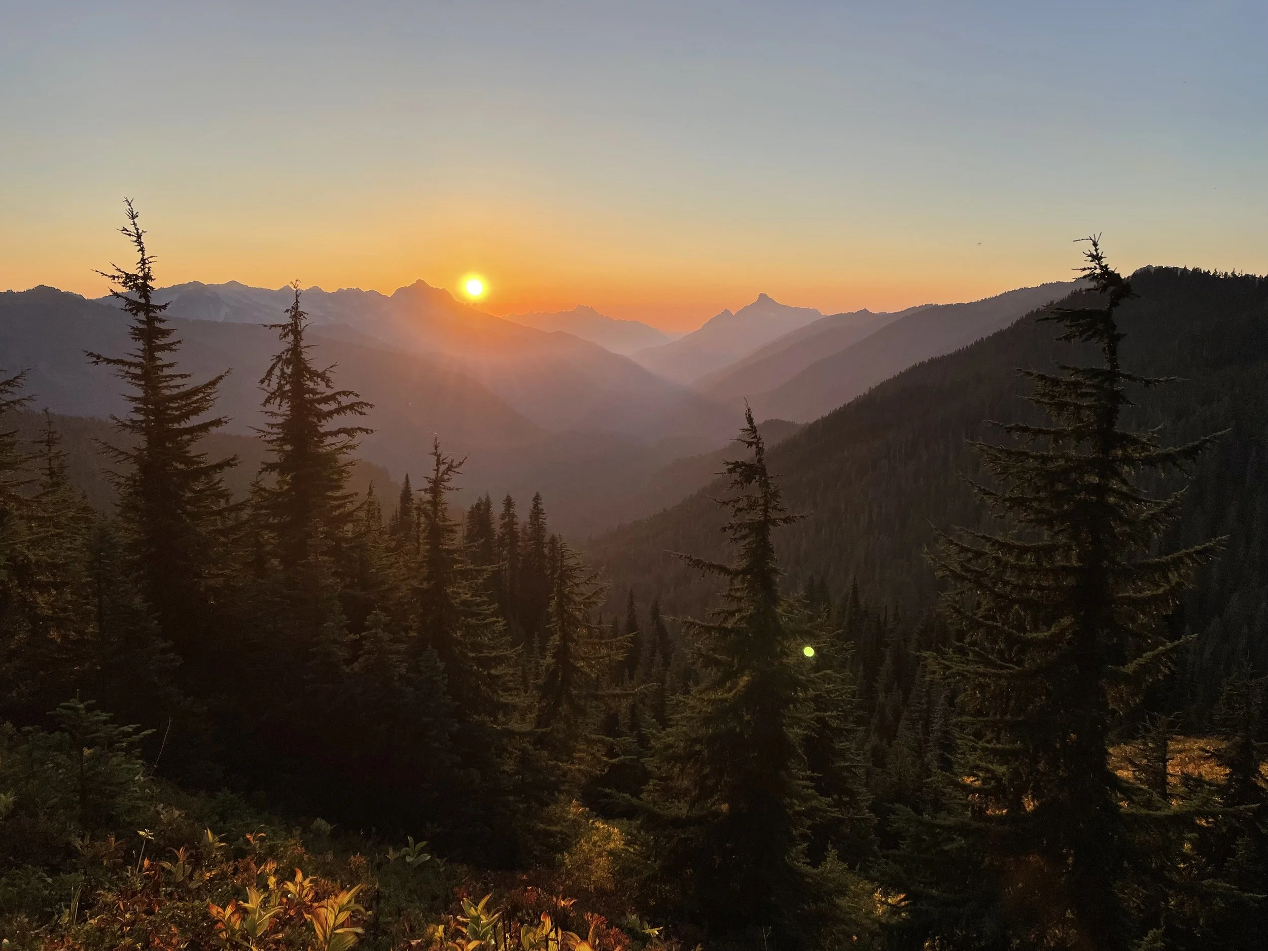
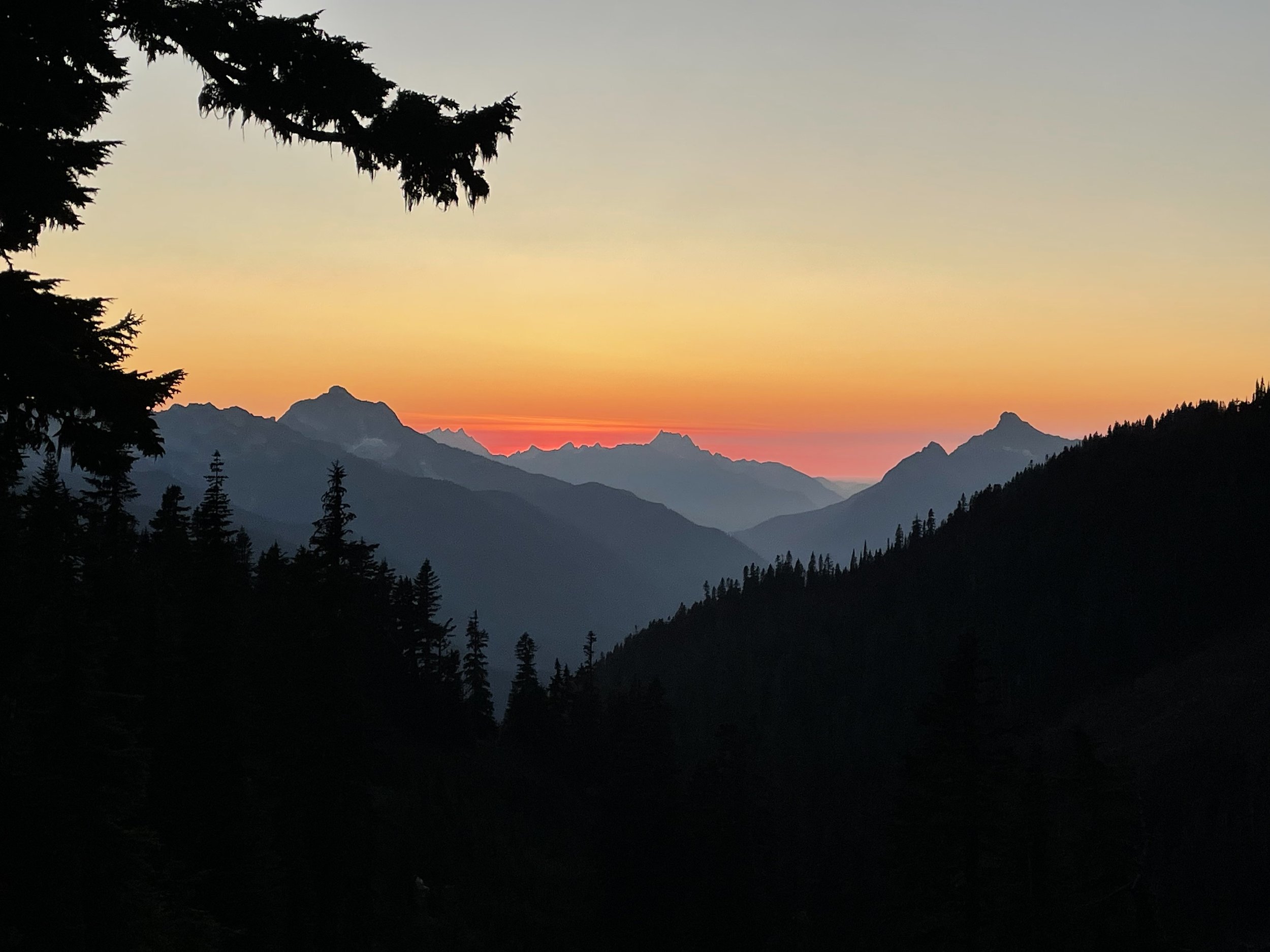
Finally at camp now at Fire Creek, and the stars are some of the best I’ve seen. There isn’t a lot of light pollution where we are, so we can even see the Milky Way.
3 more days and we’ll be in Stehekin.


Mile 2537.9
Another tough day today, but all of the climbing was worth the views. They’re beyond words. Words could never capture the depth of the beauty and majesty of the world surrounding me out here. Pictures can’t do it justice and videos feel like a feeble attempt. It’s too beautiful for even my own eyes to comprehend. I could sit in one spot and stare at the view all day. It’s hard to not stop and take pictures and videos every few steps, even though I know they’ll never be able to convey what I see in real life.
Only 2 more days until we get to Stehekin, and after that it’s only 2.5 days of actual hiking left to get us to the border. I’m feeling like tomorrow may be a tough day mentally, and potentially physically, because it’s the penultimate day of this stretch. We’re so close. But at the same time, my heart is yearning for the beauty to continue. To stay this strong, to stay in such a beautiful place, to continue moving each day and slowly taking in the world. Two more days on the last true stretch of the PCT (at least for this year). It’s an odd thing to comprehend. I think I’ll be processing this experience for years to come. 4.5 days total of hiking left. It makes me emotional, sad, teary. I’m ready to be done in a way, because I’m so ready to go home. I want to work on new goals and work toward things together with Erich. But ending this journey is hard to confront. There are days where all I want is to be done, and days where I wish it would never end. At least, the joy of hiking and backpacking in such a beautiful place - I never want that to end.
I find myself thinking of all of the things I can do when I’m done to keep myself from falling into post-trail depression. I have a feeling it’ll creep in a little bit, but I’m hopeful I can keep it at bay. Ziploc is feeling very ready to be done, I can tell she’s a bit fed up and is ready to go home. I am too, at times, but this stretch we’ve really been trying to enjoy most every moment. It can be tough because it’s long days and very tough terrain (especially the alternate we had to take a few days ago) but this has been the most beautiful area I’ve ever hiked through, and potentially the most beautiful I’ve ever seen. Maybe the intensity and toughness of the terrain is what helps make it that much more beautiful. So remote, so breathtaking, so full. The Cascades. There are no words.
Mile 2558.2
We went 20.3 miles today, our biggest day in Washington. We started the day with a descent through the forest. There were plenty of blowdowns, most of which required puzzle-solving skills and acrobatics. We kept our morale as high as we could, but blowdowns tend to make everything move so much slower than you want. The first few are always fine, but over the course of the whole Glacier Peak Wilderness we’ve probably gone over/under/through about a hundred, maybe more. With a forest this old, the trees are massive, making the blowdowns pretty crazy to navigate. Some you can just step right over, but others take several minutes, sometimes more, to figure out a way through or around.
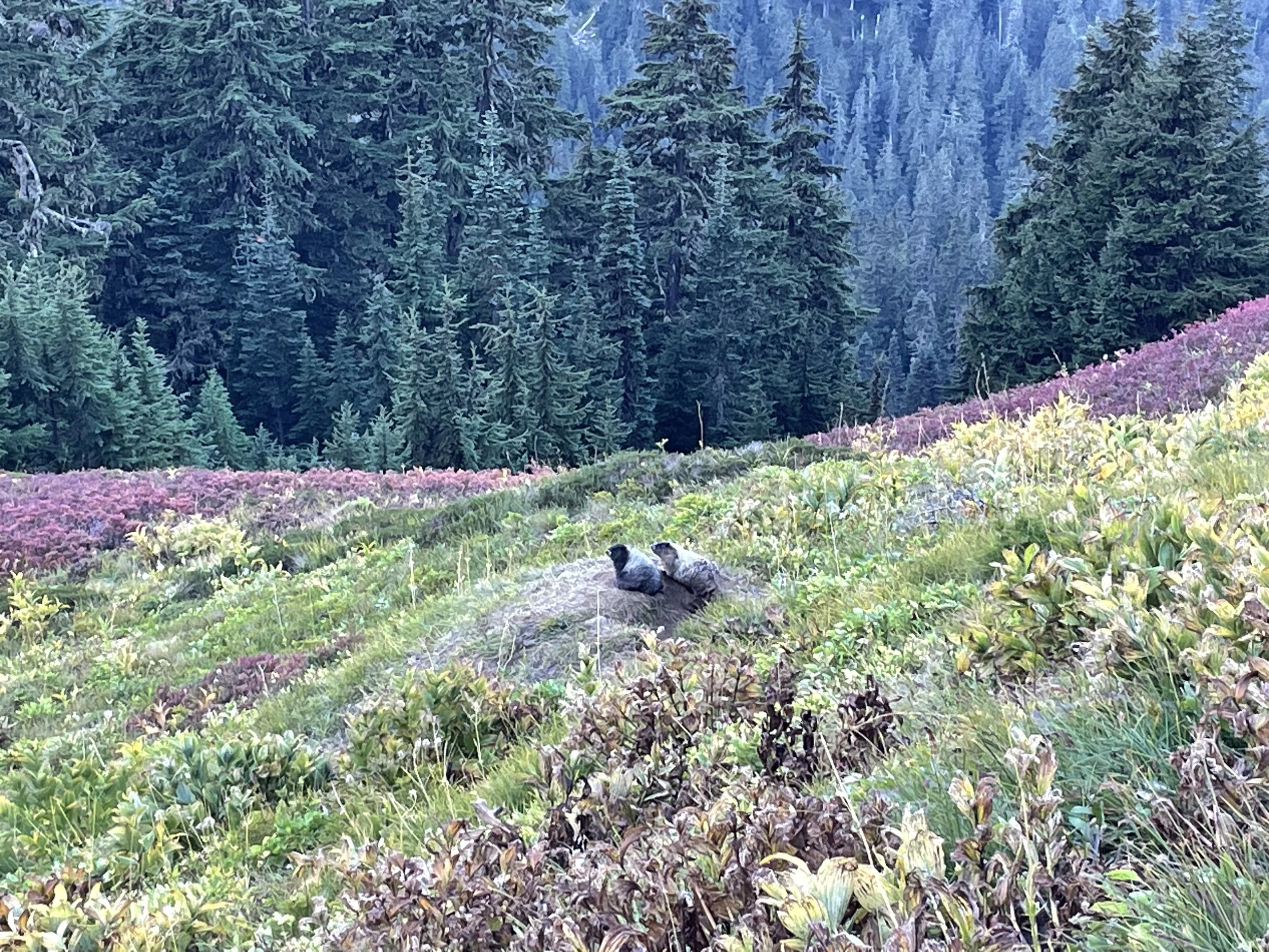
We finally made it to the Suiattle River, the last major river to cross before hitting Canada. The PCT used to hit the Suiattle river at an earlier point, but years ago the bridge was destroyed (I’m assuming by snowmelt and debris) so now you have to go like 6 miles out of the way (3 there, 3 back) just to cross on a new bridge in a safer area. It was cool to see such a big bridge in the middle of the wilderness though. It made me wonder how they got the supplies and crew in there to build it. It’s something I want to research when I’m home. Also, don’t forget to research marmots. Me and Ziploc are loving marmots right now, they’re so funny.
We climbed for the rest of the day, our final climb before we hit Stehekin. I listened to the last Harry Potter book all day which was great entertainment.
We’re less than 100 miles from Canada right now, and because of the fire closure it’s actually even less mileage. Crazy to think we only have like 3.5 hiking days left. That almost makes me a bit sick to say, even though I’m so excited to go home. Both are true.
I wish I could be more wise or write some great words for my last night before the beginning of the end, but unfortunately I’m too tired and sleep is on the way.
Camping in the middle of several massive, great peaks. Planning to leave by 6:30am tomorrow so we can try and catch the 3pm shuttle that leaves from the trailhead and goes into Stehekin.


Mile 2574.6
Made it to Stehekin today after pushing hard for 16.5 miles to catch the bus to town by 3pm. Luckily we actually managed to arrive an hour early, so we dried out our tents, threw away our trash, and got to relax a little bit before the bus arrived. It was a tough day for me, mostly the second half of the day. I dragged so badly and just wanted to eat real food and lay down. I’ve been super exhausted lately. Washington has been the most beautiful place I’ve ever seen and it’s been so rewarding, but boy it makes you work for it. It hasn’t helped that we’ve been rationing our food - both Zip and I were positively ravenous the last few days, and it was maddening not to be able to eat more out of our food bags.
The ironic part is that today was probably the easiest terrain we’ve had in all of Washington, but I think because we were hiking on a deadline to make the bus, it meant minimal, short breaks, and just pushing forward which is hard on the body and mind. Especially after a super tough 6 day stretch that turned into 7 days, and a whole month of hiking Washington’s terrain already.
We’re in Stehekin now and there’s no cell service but the ferry that’s docked in town has Starlink. We got to call our loved ones which was really nice.
On the way into town we stopped at the Stehekin Bakery, which is famous, and it did not disappoint. It was kind of surreal going in there, because I’ve imagined arriving in Stehekin many times over the years. They had so many options (pie, muffins, croissants, cookies, pizza, sandwiches, soup, literally everything), it was a glorious sight after such a long and tough stretch of trail.
I got a pumpkin muffin with cream cheese filling, a carrot cupcake with cream cheese frosting, a cheese croissant, a piece of pizza, and maybe one other thing... Ziploc also got a lot, and we decided to split one of their world-famous cinnamon buns. It’s massive, and we’re so excited to taste it and savor it tomorrow.
There’s a ton of hikers at this campground tonight, and there’s been a lot of talk about bears in the area. Generally as we’ve gone further north we’ve been warned about them more and more. I definitely heard something big moving through the bushes a little ways away a few minutes ago, and I just hope whatever it is decided to mosey on. I put all of my food and smelly items in the bear bins provided by the campground, but I know some of the other hikers nearby are still sleeping with their food. I just hope if it does come into the camp, it leaves me alone.
I get to see Erich soon, and I can’t believe I’ll be on a plane home next week. City life will be a stark contrast to what I’ve been experiencing lately.
This last stretch of trail was potentially my favorite because of how absolutely beautiful and remote it was. There were terrible things about it, like the lack of trail maintenance making some of the hiking extremely tedious and difficult. Some of the lower elevations were full of dense overgrown vegetation, and areas of mud made the trail wash away. But the beauty somehow always managed to outshine the Hell we were going through. I guess that’s typical for a successful and enjoyable thru-hike, that the good outweighs the bad. As I’m looking back over this experience, the tough and awfulness has always been there, but the joy, the friendships, the beauty, the absurdity, the quiet, the profound, have always found their way in. I’ll be so relieved to go home next week, but leaving this experience in the past will, in a way, be devastating.